Ntossoni geodata
Ntossoni (Sikasso) is a populated place; located in Mali in Africa/Bamako (GMT+0) time zone. With population of 8,700 people, there are 27 cities with bigger population in this country. Compared to other cities in Mali, 78.7% of cities are located further ↑North; 55.7% of cities are located further →East and 65.6% of cities have lower elevation than Ntossoni. Note1


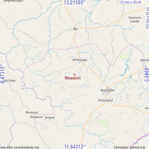
Ntossoni GPS coordinates[2]
12° 31' 49.44" North, 5° 46' 12.108" West
| Map corner | latitude | longitude |
|---|---|---|
| Upper-left | 13.21585°, | -6.47315° |
| Center: | 12.5304°, | -5.77003° |
| Lower-right: | 11.84312°, | -5.0669° |
| Map W x H: | 152.6×152.6 km | = 94.8×94.8mi |
| max Lat: | 22.67443° ⇑78.7% North |
| Ntossoni: | 12.5304° |
| min Lat: | ⇓21.3% South 10.55° |
| min Long | Ntossoni | max Long |
| -11.44448° | -5.77003° | 3.14111° |
| W 44.3%⇐ | ⇒55.7% E |
Elevation
Elevation of Ntossoni is 325 m = 1066 ft, and this is 17 m = 56 ft above average elevation for this country.
| Max E: |
540 m = 1772 ft | 34.4% |
| Ntossoni | 325 m 1066 ft | |
| Avg. | 308 m = 1010 ft | |
Min E: |
39 m = 128 ft | 65.6% |
See also: Mali elevation on elevation.city.
Geographical zone
Ntossoni is located in North Torrid zone (between Equator and Tropic of Cancer). Distance of this Northern Tropic circle is 1212.7 km =753.5 mi to North.| Distance of | km | miles | from Ntossoni |
|---|---|---|---|
| North Pole | 8613.8 | 5352.4 | to North |
| Arctic Circle | 6007.9 | 3733.1 | to North |
| Tropic Cancer | 1212.7 | 753.5 | to North |
| Equator | 1393.2 | 865.7 | to South |


Nearby cities:
15 places around Ntossoni: (largest is in red/bold)
• Barouéli
130.1 km =80.8 mi,  297°
297°
• Bla
46.7 km =29 mi,  1°
1°
• Dioila
111 km =69 mi,  267°
267°
• Kinmparana
98.1 km =61 mi,  69°
69°
• Koulikoro
197.6 km =122.8 mi,  280°
280°
• Koutiala
36.6 km =22.7 mi,  114°
114°
• Ké-Macina
165.5 km =102.8 mi,  15°
15°
• Leleni
59.1 km =36.7 mi, 105°
• Markala
134.2 km =83.4 mi,  346°
346°
• Niono
193 km =119.9 mi, 352°
• San
127.9 km =79.5 mi,  47°
47°
• Sikasso
135.3 km =84.1 mi,  175°
175°
• Ségou
111.2 km =69.1 mi,  334°
334°
• Tominian
152.8 km =94.9 mi,  56°
56°
• Yorosso
109.5 km =68 mi,  100°
100°
Sources, notices
• [Note1] Compared only with cities in Mali existing in our database
• [Src1] Map data: © OpenStreetMap contributors (CC-BY-SA)
• [Src2] Other city data from geonames.org with taken over terms of usage.
• [Src3] Geographical zone / Annual Mean Temperature by Robert A. Rohde @ Wikipedia
