Bayan geodata
Bayan (Arhangay) is a seat of a second-order administrative division; located in Mongolia in Asia/Ulaanbaatar (GMT+8) time zone. In our database, there are 33 cities with bigger population. Compared to other cities in Mongolia, 53.4% of cities are located further ↑North; 52.8% of cities are located further ←West and 58.6% of cities have higher elevation than Bayan. Note1


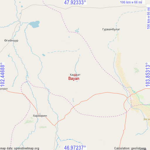
Bayan GPS coordinates[2]
47° 27' 0" North, 103° 9' 0" East
| Map corner | latitude | longitude |
|---|---|---|
| Upper-left | 47.92333°, | 102.44688° |
| Center: | 47.45°, | 103.15° |
| Lower-right: | 46.97237°, | 103.85313° |
| Map W x H: | 105.7×105.7 km | = 65.7×65.7mi |
| max Lat: | 51.50725° ⇑53.4% North |
| Bayan: | 47.45° |
| min Lat: | ⇓46.6% South 42.84199° |
| min Long | Bayan | max Long |
| 89.14358° | 103.15° | 118.51014° |
| W 52.8%⇐ | ⇒47.2% E |
Elevation
Elevation of Bayan is 1285 m = 4216 ft, and this is 131.5 m = 431 ft below average elevation for this country.
| Max E: |
2800 m = 9186 ft | 58.6% |
| Avg. | 1416.5 m = 4647 ft | |
| Bayan | 1285 m = 4216 ft | |
Min E: |
619 m = 2031 ft | 41.4% |
See also: Mongolia elevation on elevation.city.
Geographical zone
Bayan is located in North temperate zone (between Tropic of Cancer and the Arctic Circle). Distance of this North polar circle is 2125.2 km =1320.5 mi to North.| Distance of | km | miles | from Bayan |
|---|---|---|---|
| North Pole | 4731.1 | 2939.8 | to North |
| Arctic Circle | 2125.2 | 1320.5 | to North |
| Tropic Cancer | 2670 | 1659.1 | to South |
| Equator | 5275.9 | 3278.3 | to South |


Nearby cities:
15 places around Bayan: (largest is in red/bold)
• Avdzaga
34.2 km =21.3 mi,  53°
53°
• Dashinchilling
80.8 km =50.2 mi,  56°
56°
• Dzegstey
51.1 km =31.8 mi,  298°
298°
• Erhet
92.5 km =57.5 mi,  352°
352°
• Harhorin
37.3 km =23.2 mi,  221°
221°
• Hotont
52.2 km =32.4 mi,  259°
259°
• Höshööt
84.9 km =52.8 mi,  328°
328°
• Jargalant
96.1 km =59.7 mi,  293°
293°
• Kharkhorin
38.3 km =23.8 mi, 221°
• Khujirt
67.9 km =42.2 mi,  205°
205°
• Mönhbulag
82.6 km =51.3 mi,  160°
160°
• Ongon
70.7 km =43.9 mi,  137°
137°
• Sangiyn Dalay
89.8 km =55.8 mi,  171°
171°
• Tavanbulag
93.7 km =58.2 mi,  265°
265°
• Ulaanshiveet
56.1 km =34.9 mi,  108°
108°
Sources, notices
• [Note1] Compared only with cities in Mongolia existing in our database
• [Src1] Map data: © OpenStreetMap contributors (CC-BY-SA)
• [Src2] Other city data from geonames.org with taken over terms of usage.
• [Src3] Geographical zone / Annual Mean Temperature by Robert A. Rohde @ Wikipedia
