Darhan geodata
Darhan (Bulgan) is a seat of a second-order administrative division; located in Mongolia in Asia/Ulaanbaatar (GMT+8) time zone. In our database, there are 33 cities with bigger population. Compared to other cities in Mongolia, 62.6% of cities are located further ↓South; 57.1% of cities are located further ←West and 62% of cities have higher elevation than Darhan. Note1


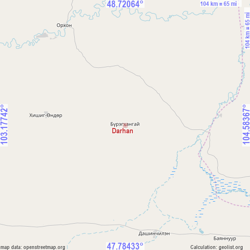
Darhan GPS coordinates[2]
48° 15' 16.668" North, 103° 52' 49.944" East
| Map corner | latitude | longitude |
|---|---|---|
| Upper-left | 48.72064°, | 103.17742° |
| Center: | 48.25463°, | 103.88054° |
| Lower-right: | 47.78433°, | 104.58367° |
| Map W x H: | 104.1×104.1 km | = 64.7×64.7mi |
| max Lat: | 51.50725° ⇑37.4% North |
| Darhan: | 48.25463° |
| min Lat: | ⇓62.6% South 42.84199° |
| min Long | Darhan | max Long |
| 89.14358° | 103.88054° | 118.51014° |
| W 57.1%⇐ | ⇒42.9% E |
Elevation
Elevation of Darhan is 1265 m = 4150 ft, and this is 151.5 m = 497 ft below average elevation for this country.
| Max E: |
2800 m = 9186 ft | 62% |
| Avg. | 1416.5 m = 4647 ft | |
| Darhan | 1265 m = 4150 ft | |
Min E: |
619 m = 2031 ft | 38% |
See also: Mongolia elevation on elevation.city.
Geographical zone
Darhan is located in North temperate zone (between Tropic of Cancer and the Arctic Circle). Distance of this North polar circle is 2035.8 km =1265 mi to North.| Distance of | km | miles | from Darhan |
|---|---|---|---|
| North Pole | 4641.7 | 2884.2 | to North |
| Arctic Circle | 2035.8 | 1265 | to North |
| Tropic Cancer | 2759.5 | 1714.7 | to South |
| Equator | 5365.4 | 3333.9 | to South |


Nearby cities:
15 places around Darhan: (largest is in red/bold)
• Avdzaga
74.2 km =46.1 mi,  201°
201°
• Bat-Öldziyt
66.3 km =41.2 mi,  93°
93°
• Bayan
104.8 km =65.1 mi,  211°
211°
• Bugat
91.7 km =57 mi,  350°
350°
• Bulgan
67.1 km =41.7 mi,  337°
337°
• Dashinchilling
46.7 km =29 mi,  164°
164°
• Erdenet
87.9 km =54.6 mi,  9°
9°
• Erhet
66.6 km =41.4 mi,  271°
271°
• Höshööt
99.6 km =61.9 mi,  260°
260°
• Hüremt
103.3 km =64.2 mi,  296°
296°
• Jargalant
104.7 km =65.1 mi,  21°
21°
• Maanĭt
34 km =21.1 mi,  277°
277°
• Mandal
49.2 km =30.6 mi,  328°
328°
• Tsul-Ulaan
65.7 km =40.8 mi,  135°
135°
• Ulaanshiveet
107.3 km =66.7 mi,  180°
180°
Sources, notices
• [Note1] Compared only with cities in Mongolia existing in our database
• [Src1] Map data: © OpenStreetMap contributors (CC-BY-SA)
• [Src2] Other city data from geonames.org with taken over terms of usage.
• [Src3] Geographical zone / Annual Mean Temperature by Robert A. Rohde @ Wikipedia
