Tsetserleg geodata
Tsetserleg (Arhangay) is a seat of a first-order administrative division; located in Mongolia in Asia/Ulaanbaatar (GMT+8) time zone. With population of 5,876 people, there are 27 cities with bigger population in this country. Compared to other cities in Mongolia, 53.1% of cities are located further ↑North; 57.4% of cities are located further →East and 75.5% of cities have lower elevation than Tsetserleg. Note1


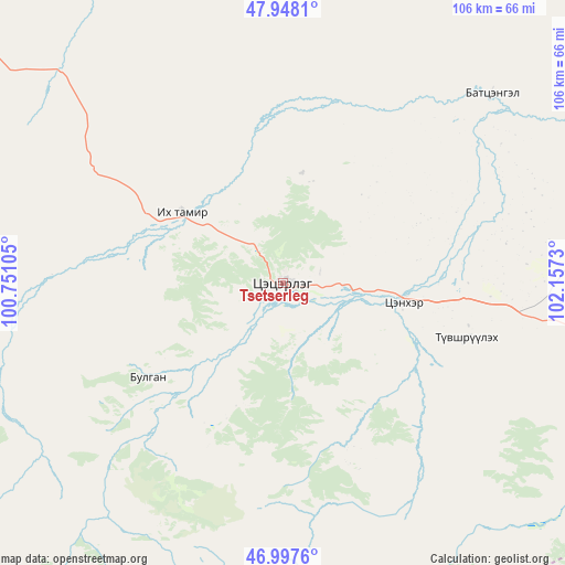
Tsetserleg GPS coordinates[2]
47° 28' 30" North, 101° 27' 15.012" East
| Map corner | latitude | longitude |
|---|---|---|
| Upper-left | 47.9481°, | 100.75105° |
| Center: | 47.475°, | 101.45417° |
| Lower-right: | 46.9976°, | 102.1573° |
| Map W x H: | 105.7×105.7 km | = 65.7×65.7mi |
| max Lat: | 51.50725° ⇑53.1% North |
| Tsetserleg: | 47.475° |
| min Lat: | ⇓46.9% South 42.84199° |
| min Long | Tsetserleg | max Long |
| 89.14358° | 101.45417° | 118.51014° |
| W 42.6%⇐ | ⇒57.4% E |
Elevation
Elevation of Tsetserleg is 1705 m = 5594 ft, and this is 288.5 m = 947 ft above average elevation for this country.
| Max E: |
2800 m = 9186 ft | 24.5% |
| Tsetserleg | 1705 m 5594 ft | |
| Avg. | 1416.5 m = 4647 ft | |
Min E: |
619 m = 2031 ft | 75.5% |
See also: Mongolia elevation on elevation.city.
Geographical zone
Tsetserleg is located in North temperate zone (between Tropic of Cancer and the Arctic Circle). Distance of this North polar circle is 2122.4 km =1318.8 mi to North.| Distance of | km | miles | from Tsetserleg |
|---|---|---|---|
| North Pole | 4728.3 | 2938 | to North |
| Arctic Circle | 2122.4 | 1318.8 | to North |
| Tropic Cancer | 2672.8 | 1660.8 | to South |
| Equator | 5278.7 | 3280 | to South |


Nearby cities:
15 places around Tsetserleg: (largest is in red/bold)
• Altan-Ovoo
22.8 km =14.2 mi,  97°
97°
• Bulagiyn Denj
30.8 km =19.1 mi,  235°
235°
• Dzaanhoshuu
43.3 km =26.9 mi,  272°
272°
• Dzegstey
85 km =52.8 mi,  75°
75°
• Harhorin
107.7 km =66.9 mi,  106°
106°
• Hotont
77.3 km =48 mi, 99°
• Höshööt
107.8 km =67 mi,  49°
49°
• Jargalant
52.5 km =32.6 mi, 47°
• Jargalant
93.2 km =57.9 mi, 273°
• Kharkhorin
107.1 km =66.5 mi, 107°
• Khujirt
118.3 km =73.5 mi,  122°
122°
• Tavanbulag
35.7 km =22.2 mi, 106°
• Teel
95 km =59 mi,  311°
311°
• Öldziyt
117.3 km =72.9 mi,  357°
357°
• Övt
94.8 km =58.9 mi,  140°
140°
Sources, notices
• [Note1] Compared only with cities in Mongolia existing in our database
• [Src1] Map data: © OpenStreetMap contributors (CC-BY-SA)
• [Src2] Other city data from geonames.org with taken over terms of usage.
• [Src3] Geographical zone / Annual Mean Temperature by Robert A. Rohde @ Wikipedia
