Altan-Ovoo geodata
Altan-Ovoo (Arhangay) is a seat of a second-order administrative division; located in Mongolia in Asia/Ulaanbaatar (GMT+8) time zone. In our database, there are 33 cities with bigger population. Compared to other cities in Mongolia, 53.7% of cities are located further ↑North; 55.8% of cities are located further →East and 67.5% of cities have lower elevation than Altan-Ovoo. Note1


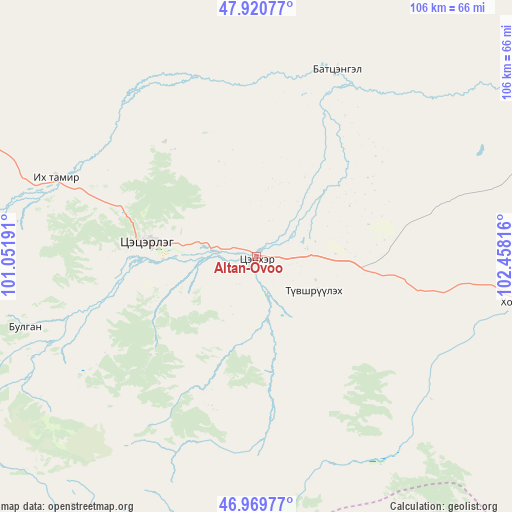
Altan-Ovoo GPS coordinates[2]
47° 26' 50.712" North, 101° 45' 18.108" East
| Map corner | latitude | longitude |
|---|---|---|
| Upper-left | 47.92077°, | 101.05191° |
| Center: | 47.44742°, | 101.75503° |
| Lower-right: | 46.96977°, | 102.45816° |
| Map W x H: | 105.7×105.7 km | = 65.7×65.7mi |
| max Lat: | 51.50725° ⇑53.7% North |
| Altan-Ovoo: | 47.44742° |
| min Lat: | ⇓46.3% South 42.84199° |
| min Long | Altan-Ovoo | max Long |
| 89.14358° | 101.75503° | 118.51014° |
| W 44.2%⇐ | ⇒55.8% E |
Elevation
Elevation of Altan-Ovoo is 1572 m = 5157 ft, and this is 155.5 m = 510 ft above average elevation for this country.
| Max E: |
2800 m = 9186 ft | 32.5% |
| Altan-Ovoo | 1572 m 5157 ft | |
| Avg. | 1416.5 m = 4647 ft | |
Min E: |
619 m = 2031 ft | 67.5% |
See also: Mongolia elevation on elevation.city.
Geographical zone
Altan-Ovoo is located in North temperate zone (between Tropic of Cancer and the Arctic Circle). Distance of this North polar circle is 2125.5 km =1320.7 mi to North.| Distance of | km | miles | from Altan-Ovoo |
|---|---|---|---|
| North Pole | 4731.4 | 2940 | to North |
| Arctic Circle | 2125.5 | 1320.7 | to North |
| Tropic Cancer | 2669.7 | 1658.9 | to South |
| Equator | 5275.7 | 3278.2 | to South |


Nearby cities:
15 places around Altan-Ovoo: (largest is in red/bold)
• Bayan
104.9 km =65.2 mi,  89°
89°
• Bulagiyn Denj
50.2 km =31.2 mi,  253°
253°
• Dzaanhoshuu
66.1 km =41.1 mi,  274°
274°
• Dzegstey
64.5 km =40.1 mi,  67°
67°
• Harhorin
85.2 km =52.9 mi,  109°
109°
• Hotont
54.5 km =33.9 mi,  99°
99°
• Höshööt
94.2 km =58.5 mi,  39°
39°
• Jargalant
41.7 km =25.9 mi,  22°
22°
• Jargalant
116 km =72.1 mi, 274°
• Kharkhorin
84.7 km =52.6 mi, 109°
• Khujirt
98.1 km =61 mi,  128°
128°
• Tavanbulag
13.6 km =8.5 mi,  122°
122°
• Teel
114.5 km =71.1 mi,  305°
305°
• Tsetserleg
22.8 km =14.2 mi,  277°
277°
• Övt
79.5 km =49.4 mi,  151°
151°
Sources, notices
• [Note1] Compared only with cities in Mongolia existing in our database
• [Src1] Map data: © OpenStreetMap contributors (CC-BY-SA)
• [Src2] Other city data from geonames.org with taken over terms of usage.
• [Src3] Geographical zone / Annual Mean Temperature by Robert A. Rohde @ Wikipedia
