Hovd geodata
Hovd (Övörhangay) is a seat of a second-order administrative division; located in Mongolia in Asia/Ulaanbaatar (GMT+8) time zone. In our database, there are 33 cities with bigger population. Compared to other cities in Mongolia, 92.9% of cities are located further ↑North; 52.5% of cities are located further →East and 55.8% of cities have lower elevation than Hovd. Note1


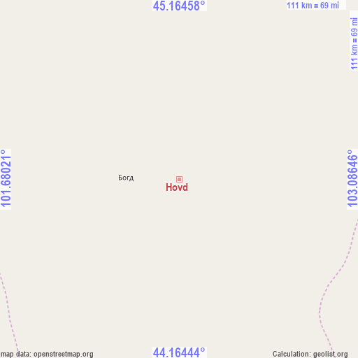
Hovd GPS coordinates[2]
44° 40' 0.012" North, 102° 22' 59.988" East
| Map corner | latitude | longitude |
|---|---|---|
| Upper-left | 45.16458°, | 101.68021° |
| Center: | 44.66667°, | 102.38333° |
| Lower-right: | 44.16444°, | 103.08646° |
| Map W x H: | 111.2×111.2 km | = 69.1×69.1mi |
| max Lat: | 51.50725° ⇑92.9% North |
| Hovd: | 44.66667° |
| min Lat: | ⇓7.1% South 42.84199° |
| min Long | Hovd | max Long |
| 89.14358° | 102.38333° | 118.51014° |
| W 47.5%⇐ | ⇒52.5% E |
Elevation
Elevation of Hovd is 1446 m = 4744 ft, and this is 29.5 m = 97 ft above average elevation for this country.
| Max E: |
2800 m = 9186 ft | 44.2% |
| Hovd | 1446 m 4744 ft | |
| Avg. | 1416.5 m = 4647 ft | |
Min E: |
619 m = 2031 ft | 55.8% |
See also: Mongolia elevation on elevation.city.
Geographical zone
Hovd is located in North temperate zone (between Tropic of Cancer and the Arctic Circle). Distance of this Northern Tropic circle is 2360.5 km =1466.7 mi to South.| Distance of | km | miles | from Hovd |
|---|---|---|---|
| North Pole | 5040.6 | 3132.1 | to North |
| Arctic Circle | 2434.7 | 1512.9 | to North |
| Tropic Cancer | 2360.5 | 1466.7 | to South |
| Equator | 4966.5 | 3086 | to South |


Nearby cities:
15 places around Hovd: (largest is in red/bold)
• Arguut
88.6 km =55.1 mi,  1°
1°
• Bayan Uula Sumu
95.3 km =59.2 mi,  305°
305°
• Bulgan
111.8 km =69.5 mi,  124°
124°
• Dalay
161 km =100 mi,  145°
145°
• Hatansuudal
123.9 km =77 mi,  263°
263°
• Hoolt
107.3 km =66.7 mi,  26°
26°
• Horiult
140.4 km =87.2 mi,  294°
294°
• Hovd
16.5 km =10.3 mi,  271°
271°
• Mardzad
145.1 km =90.2 mi,  349°
349°
• Ongi
147.6 km =91.7 mi,  53°
53°
• Saynshand
117.4 km =72.9 mi,  174°
174°
• Sharhulsan
131.8 km =81.9 mi,  90°
90°
• Shiree
153.8 km =95.6 mi, 31°
• Tsagaan-Ovoo
161.3 km =100.2 mi,  333°
333°
• Örgön
157.6 km =97.9 mi, 272°
Sources, notices
• [Note1] Compared only with cities in Mongolia existing in our database
• [Src1] Map data: © OpenStreetMap contributors (CC-BY-SA)
• [Src2] Other city data from geonames.org with taken over terms of usage.
• [Src3] Geographical zone / Annual Mean Temperature by Robert A. Rohde @ Wikipedia
