Saynshand geodata
Saynshand (Ömnögovĭ) is a seat of a second-order administrative division; located in Mongolia in Asia/Ulaanbaatar (GMT+8) time zone. In our database, there are 33 cities with bigger population. Compared to other cities in Mongolia, 96.6% of cities are located further ↑North; 51.2% of cities are located further →East and 90.5% of cities have lower elevation than Saynshand. Note1


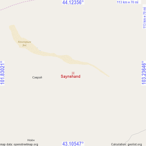
Saynshand GPS coordinates[2]
43° 37' 0.012" North, 102° 31' 59.988" East
| Map corner | latitude | longitude |
|---|---|---|
| Upper-left | 44.12356°, | 101.83021° |
| Center: | 43.61667°, | 102.53333° |
| Lower-right: | 43.10547°, | 103.23646° |
| Map W x H: | 113.2×113.2 km | = 70.3×70.3mi |
| max Lat: | 51.50725° ⇑96.6% North |
| Saynshand: | 43.61667° |
| min Lat: | ⇓3.4% South 42.84199° |
| min Long | Saynshand | max Long |
| 89.14358° | 102.53333° | 118.51014° |
| W 48.8%⇐ | ⇒51.2% E |
Elevation
Elevation of Saynshand is 2031 m = 6663 ft, and this is 614.5 m = 2016 ft above average elevation for this country.
| Max E: |
2800 m = 9186 ft | 9.5% |
| Saynshand | 2031 m 6663 ft | |
| Avg. | 1416.5 m = 4647 ft | |
Min E: |
619 m = 2031 ft | 90.5% |
See also: Mongolia elevation on elevation.city.
Geographical zone
Saynshand is located in North temperate zone (between Tropic of Cancer and the Arctic Circle). Distance of this Northern Tropic circle is 2243.8 km =1394.2 mi to South.| Distance of | km | miles | from Saynshand |
|---|---|---|---|
| North Pole | 5157.3 | 3204.6 | to North |
| Arctic Circle | 2551.5 | 1585.4 | to North |
| Tropic Cancer | 2243.8 | 1394.2 | to South |
| Equator | 4849.7 | 3013.5 | to South |


Nearby cities:
15 places around Saynshand: (largest is in red/bold)
• Arguut
205.5 km =127.7 mi,  357°
357°
• Bayan Uula Sumu
194.4 km =120.8 mi,  332°
332°
• Bulgan
97 km =60.3 mi,  56°
56°
• Dalandzadgad
152.4 km =94.7 mi,  91°
91°
• Dalay
80.7 km =50.1 mi,  101°
101°
• Hatansuudal
171 km =106.3 mi,  307°
307°
• Hoolt
216.1 km =134.3 mi,  9°
9°
• Hovd
117.4 km =72.9 mi,  354°
354°
• Hovd
120.6 km =74.9 mi, 346°
• Noyon Suma
59 km =36.7 mi,  213°
213°
• Sharhulsan
166.9 km =103.7 mi,  46°
46°
• Tsoohor
129 km =80.2 mi,  105°
105°
• Urt
127.3 km =79.1 mi,  250°
250°
• Ögöömör
157.6 km =97.9 mi,  83°
83°
• Örgön
211.4 km =131.4 mi, 306°
Sources, notices
• [Note1] Compared only with cities in Mongolia existing in our database
• [Src1] Map data: © OpenStreetMap contributors (CC-BY-SA)
• [Src2] Other city data from geonames.org with taken over terms of usage.
• [Src3] Geographical zone / Annual Mean Temperature by Robert A. Rohde @ Wikipedia
