Hatansuudal geodata
Hatansuudal (Bayanhongor) is a seat of a second-order administrative division; located in Mongolia in Asia/Ulaanbaatar (GMT+8) time zone. In our database, there are 33 cities with bigger population. Compared to other cities in Mongolia, 93.9% of cities are located further ↑North; 60.4% of cities are located further →East and 52.8% of cities have higher elevation than Hatansuudal. Note1


Hatansuudal GPS coordinates[2]
44° 32' 45.42" North, 100° 49' 40.368" East
| Map corner | latitude | longitude |
|---|---|---|
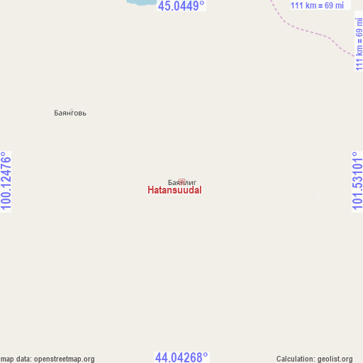
| Upper-left | 45.0449°, | 100.12476° |
| Center: | 44.54595°, | 100.82788° |
| Lower-right: | 44.04268°, | 101.53101° |
| Map W x H: | 111.4×111.4 km | = 69.2×69.2mi |
| max Lat: | 51.50725° ⇑93.9% North |
| Hatansuudal: | 44.54595° |
| min Lat: | ⇓6.1% South 42.84199° |
| min Long | Hatansuudal | max Long |
| 89.14358° | 100.82788° | 118.51014° |
| W 39.6%⇐ | ⇒60.4% E |
Elevation
Elevation of Hatansuudal is 1345 m = 4413 ft, and this is 71.5 m = 235 ft below average elevation for this country.
| Max E: |
2800 m = 9186 ft | 52.8% |
| Avg. | 1416.5 m = 4647 ft | |
| Hatansuudal | 1345 m = 4413 ft | |
Min E: |
619 m = 2031 ft | 47.2% |
See also: Mongolia elevation on elevation.city.
Geographical zone
Hatansuudal is located in North temperate zone (between Tropic of Cancer and the Arctic Circle). Distance of this Northern Tropic circle is 2347.1 km =1458.4 mi to South.| Distance of | km | miles | from Hatansuudal |
|---|---|---|---|
| North Pole | 5054 | 3140.4 | to North |
| Arctic Circle | 2448.1 | 1521.2 | to North |
| Tropic Cancer | 2347.1 | 1458.4 | to South |
| Equator | 4953 | 3077.7 | to South |


Nearby cities:
15 places around Hatansuudal: (largest is in red/bold)
• Arguut
161.5 km =100.4 mi,  50°
50°
• Bayan Uula Sumu
82.4 km =51.2 mi,  33°
33°
• Bayansayr
156.8 km =97.4 mi,  315°
315°
• Bodĭ
98.3 km =61.1 mi,  348°
348°
• Bulgan
174.2 km =108.2 mi,  278°
278°
• Dzalaa
123.7 km =76.9 mi,  269°
269°
• Horiult
72.9 km =45.3 mi,  356°
356°
• Hovd
107.5 km =66.8 mi,  82°
82°
• Hovd
123.9 km =77 mi, 83°
• Mardzad
183.1 km =113.8 mi, 31°
• Saynshand
171 km =106.3 mi,  127°
127°
• Tsagaan-Ovoo
165.3 km =102.7 mi,  17°
17°
• Ulaan-Uul
169.2 km =105.1 mi, 359°
• Urt
147.1 km =91.4 mi,  173°
173°
• Örgön
40.5 km =25.2 mi,  301°
301°
Sources, notices
• [Note1] Compared only with cities in Mongolia existing in our database
• [Src1] Map data: © OpenStreetMap contributors (CC-BY-SA)
• [Src2] Other city data from geonames.org with taken over terms of usage.
• [Src3] Geographical zone / Annual Mean Temperature by Robert A. Rohde @ Wikipedia
