Modot geodata
Modot (Hentiy) is a seat of a second-order administrative division; located in Mongolia in Asia/Ulaanbaatar (GMT+8) time zone. In our database, there are 33 cities with bigger population. Compared to other cities in Mongolia, 52.1% of cities are located further ↓South; 83.4% of cities are located further ←West and 62.6% of cities have lower elevation than Modot. Note1


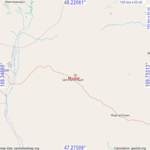
Modot GPS coordinates[2]
47° 45' 0" North, 109° 3' 0" East
| Map corner | latitude | longitude |
|---|---|---|
| Upper-left | 48.22061°, | 108.34688° |
| Center: | 47.75°, | 109.05° |
| Lower-right: | 47.27509°, | 109.75313° |
| Map W x H: | 105.1×105.1 km | = 65.3×65.3mi |
| max Lat: | 51.50725° ⇑47.9% North |
| Modot: | 47.75° |
| min Lat: | ⇓52.1% South 42.84199° |
| min Long | Modot | max Long |
| 89.14358° | 109.05° | 118.51014° |
| W 83.4%⇐ | ⇒16.6% E |
Elevation
Elevation of Modot is 1505 m = 4938 ft, and this is 88.5 m = 290 ft above average elevation for this country.
| Max E: |
2800 m = 9186 ft | 37.4% |
| Modot | 1505 m 4938 ft | |
| Avg. | 1416.5 m = 4647 ft | |
Min E: |
619 m = 2031 ft | 62.6% |
See also: Mongolia elevation on elevation.city.
Geographical zone
Modot is located in North temperate zone (between Tropic of Cancer and the Arctic Circle). Distance of this North polar circle is 2091.9 km =1299.8 mi to North.| Distance of | km | miles | from Modot |
|---|---|---|---|
| North Pole | 4697.8 | 2919.1 | to North |
| Arctic Circle | 2091.9 | 1299.8 | to North |
| Tropic Cancer | 2703.4 | 1679.8 | to South |
| Equator | 5309.3 | 3299 | to South |


Nearby cities:
15 places around Modot: (largest is in red/bold)
• Arhust
87.3 km =54.2 mi,  273°
273°
• Avraga
64.4 km =40 mi,  170°
170°
• Bayan
147.8 km =91.8 mi,  116°
116°
• Bayanbulag
66 km =41 mi,  78°
78°
• Bayandelger
70.3 km =43.7 mi, 267°
• Bayantal
143.6 km =89.2 mi,  203°
203°
• Bayasgalant
86.9 km =54 mi,  223°
223°
• Bulag
65.4 km =40.6 mi,  319°
319°
• Darhan
129 km =80.2 mi, 167°
• Eg
133.5 km =83 mi,  38°
38°
• Herlen
124.4 km =77.3 mi,  113°
113°
• Maanĭt
126.8 km =78.8 mi,  243°
243°
• Mörön
103.4 km =64.2 mi, 113°
• Ulaan-Ereg
108.2 km =67.2 mi,  150°
150°
• Undurkhaan
129.7 km =80.6 mi, 111°
Sources, notices
• [Note1] Compared only with cities in Mongolia existing in our database
• [Src1] Map data: © OpenStreetMap contributors (CC-BY-SA)
• [Src2] Other city data from geonames.org with taken over terms of usage.
• [Src3] Geographical zone / Annual Mean Temperature by Robert A. Rohde @ Wikipedia
