Bayantal geodata
Bayantal (Govĭ-Sumber) is a seat of a second-order administrative division; located in Mongolia in Asia/Ulaanbaatar (GMT+8) time zone. In our database, there are 33 cities with bigger population. Compared to other cities in Mongolia, 69.3% of cities are located further ↑North; 81.9% of cities are located further ←West and 59.8% of cities have higher elevation than Bayantal. Note1


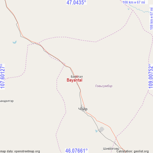
Bayantal GPS coordinates[2]
46° 33' 43.956" North, 108° 18' 15.804" East
| Map corner | latitude | longitude |
|---|---|---|
| Upper-left | 47.0435°, | 107.60127° |
| Center: | 46.56221°, | 108.30439° |
| Lower-right: | 46.07661°, | 109.00752° |
| Map W x H: | 107.5×107.5 km | = 66.8×66.8mi |
| max Lat: | 51.50725° ⇑69.3% North |
| Bayantal: | 46.56221° |
| min Lat: | ⇓30.7% South 42.84199° |
| min Long | Bayantal | max Long |
| 89.14358° | 108.30439° | 118.51014° |
| W 81.9%⇐ | ⇒18.1% E |
Elevation
Elevation of Bayantal is 1277 m = 4190 ft, and this is 139.5 m = 458 ft below average elevation for this country.
| Max E: |
2800 m = 9186 ft | 59.8% |
| Avg. | 1416.5 m = 4647 ft | |
| Bayantal | 1277 m = 4190 ft | |
Min E: |
619 m = 2031 ft | 40.2% |
See also: Mongolia elevation on elevation.city.
Geographical zone
Bayantal is located in North temperate zone (between Tropic of Cancer and the Arctic Circle). Distance of this North polar circle is 2223.9 km =1381.9 mi to North.| Distance of | km | miles | from Bayantal |
|---|---|---|---|
| North Pole | 4829.8 | 3001.1 | to North |
| Arctic Circle | 2223.9 | 1381.9 | to North |
| Tropic Cancer | 2571.3 | 1597.7 | to South |
| Equator | 5177.2 | 3217 | to South |


Nearby cities:
15 places around Bayantal: (largest is in red/bold)
• Argatay
91.8 km =57 mi,  195°
195°
• Avraga
96 km =59.7 mi,  44°
44°
• Bayandelger
130.4 km =81 mi,  353°
353°
• Bayasgalant
68.7 km =42.7 mi,  357°
357°
• Choyr
22.8 km =14.2 mi,  169°
169°
• Darhan
85.2 km =52.9 mi,  85°
85°
• Dzogsool
91.9 km =57.1 mi,  286°
286°
• Hajuu-Us
84.6 km =52.6 mi,  227°
227°
• Haraat
52.6 km =32.7 mi,  252°
252°
• Maanĭt
96.3 km =59.8 mi,  322°
322°
• Shiveegovĭ
56.3 km =35 mi,  154°
154°
• Tsagaandörvölj
115.4 km =71.7 mi,  137°
137°
• Tsant
128.9 km =80.1 mi, 250°
• Tsomog
92.7 km =57.6 mi, 140°
• Ulaan-Ereg
116.4 km =72.3 mi,  71°
71°
Sources, notices
• [Note1] Compared only with cities in Mongolia existing in our database
• [Src1] Map data: © OpenStreetMap contributors (CC-BY-SA)
• [Src2] Other city data from geonames.org with taken over terms of usage.
• [Src3] Geographical zone / Annual Mean Temperature by Robert A. Rohde @ Wikipedia
