Avraga geodata
Avraga (Hentiy) is a seat of a second-order administrative division; located in Mongolia in Asia/Ulaanbaatar (GMT+8) time zone. In our database, there are 33 cities with bigger population. Compared to other cities in Mongolia, 59.2% of cities are located further ↑North; 84.4% of cities are located further ←West and 65% of cities have higher elevation than Avraga. Note1


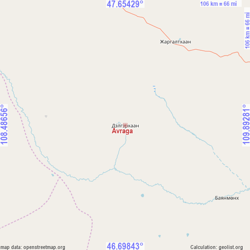
Avraga GPS coordinates[2]
47° 10' 42.636" North, 109° 11' 22.848" East
| Map corner | latitude | longitude |
|---|---|---|
| Upper-left | 47.65429°, | 108.48656° |
| Center: | 47.17851°, | 109.18968° |
| Lower-right: | 46.69843°, | 109.89281° |
| Map W x H: | 106.3×106.3 km | = 66.1×66.1mi |
| max Lat: | 51.50725° ⇑59.2% North |
| Avraga: | 47.17851° |
| min Lat: | ⇓40.8% South 42.84199° |
| min Long | Avraga | max Long |
| 89.14358° | 109.18968° | 118.51014° |
| W 84.4%⇐ | ⇒15.6% E |
Elevation
Elevation of Avraga is 1241 m = 4072 ft, and this is 175.5 m = 576 ft below average elevation for this country.
| Max E: |
2800 m = 9186 ft | 65% |
| Avg. | 1416.5 m = 4647 ft | |
| Avraga | 1241 m = 4072 ft | |
Min E: |
619 m = 2031 ft | 35% |
See also: Mongolia elevation on elevation.city.
Geographical zone
Avraga is located in North temperate zone (between Tropic of Cancer and the Arctic Circle). Distance of this North polar circle is 2155.4 km =1339.3 mi to North.| Distance of | km | miles | from Avraga |
|---|---|---|---|
| North Pole | 4761.3 | 2958.5 | to North |
| Arctic Circle | 2155.4 | 1339.3 | to North |
| Tropic Cancer | 2639.8 | 1640.3 | to South |
| Equator | 5245.8 | 3259.6 | to South |


Nearby cities:
15 places around Avraga: (largest is in red/bold)
• Arhust
119.7 km =74.4 mi,  304°
304°
• Bayan
123 km =76.4 mi,  90°
90°
• Bayanbulag
94 km =58.4 mi,  35°
35°
• Bayandelger
101.5 km =63.1 mi,  306°
306°
• Bayantal
96 km =59.7 mi,  224°
224°
• Bayasgalant
70.3 km =43.7 mi,  270°
270°
• Bulag
125.3 km =77.9 mi,  335°
335°
• Choyr
110.6 km =68.7 mi,  214°
214°
• Darhan
64.8 km =40.3 mi,  164°
164°
• Herlen
104.8 km =65.1 mi,  82°
82°
• Maanĭt
125.3 km =77.9 mi, 273°
• Modot
64.4 km =40 mi,  350°
350°
• Mörön
88 km =54.7 mi, 75°
• Ulaan-Ereg
52.6 km =32.7 mi,  126°
126°
• Undurkhaan
111.7 km =69.4 mi, 81°
Sources, notices
• [Note1] Compared only with cities in Mongolia existing in our database
• [Src1] Map data: © OpenStreetMap contributors (CC-BY-SA)
• [Src2] Other city data from geonames.org with taken over terms of usage.
• [Src3] Geographical zone / Annual Mean Temperature by Robert A. Rohde @ Wikipedia
