Orgil geodata
Orgil (Central Aimak) is a seat of a second-order administrative division; located in Mongolia in Asia/Ulaanbaatar (GMT+8) time zone. In our database, there are 33 cities with bigger population. Compared to other cities in Mongolia, 65.6% of cities are located further ↓South; 64.7% of cities are located further ←West and 78.5% of cities have higher elevation than Orgil. Note1


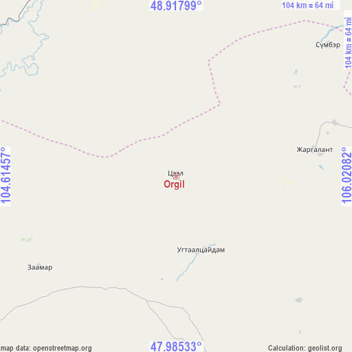
Orgil GPS coordinates[2]
48° 27' 13.68" North, 105° 19' 3.684" East
| Map corner | latitude | longitude |
|---|---|---|
| Upper-left | 48.91799°, | 104.61457° |
| Center: | 48.4538°, | 105.31769° |
| Lower-right: | 47.98533°, | 106.02082° |
| Map W x H: | 103.7×103.7 km | = 64.4×64.4mi |
| max Lat: | 51.50725° ⇑34.4% North |
| Orgil: | 48.4538° |
| min Lat: | ⇓65.6% South 42.84199° |
| min Long | Orgil | max Long |
| 89.14358° | 105.31769° | 118.51014° |
| W 64.7%⇐ | ⇒35.3% E |
Elevation
Elevation of Orgil is 1055 m = 3461 ft, and this is 361.5 m = 1186 ft below average elevation for this country.
| Max E: |
2800 m = 9186 ft | 78.5% |
| Avg. | 1416.5 m = 4647 ft | |
| Orgil | 1055 m = 3461 ft | |
Min E: |
619 m = 2031 ft | 21.5% |
See also: Mongolia elevation on elevation.city.
Geographical zone
Orgil is located in North temperate zone (between Tropic of Cancer and the Arctic Circle). Distance of this North polar circle is 2013.6 km =1251.2 mi to North.| Distance of | km | miles | from Orgil |
|---|---|---|---|
| North Pole | 4619.5 | 2870.4 | to North |
| Arctic Circle | 2013.6 | 1251.2 | to North |
| Tropic Cancer | 2781.6 | 1728.4 | to South |
| Equator | 5387.6 | 3347.7 | to South |


Nearby cities:
15 places around Orgil: (largest is in red/bold)
• Ar-Asgat
22.4 km =13.9 mi,  161°
161°
• Argalant
71.2 km =44.2 mi,  143°
143°
• Bat-Öldziyt
48.2 km =30 mi,  236°
236°
• Bornuur
70 km =43.5 mi,  88°
88°
• Dund-Urt
64.3 km =40 mi, 135°
• Enhtal
88.3 km =54.9 mi,  2°
2°
• Ihsüüj
76.3 km =47.4 mi,  109°
109°
• Jargalant
41.3 km =25.7 mi,  79°
79°
• Javhlant
59 km =36.7 mi,  49°
49°
• Nart
77 km =47.8 mi, 3°
• Nomgon
86.8 km =53.9 mi,  17°
17°
• Orhontuul
60.6 km =37.7 mi,  335°
335°
• Sujji
65.5 km =40.7 mi,  184°
184°
• Tsul-Ulaan
91.9 km =57.1 mi,  221°
221°
• Ulaanhad
58.7 km =36.5 mi, 162°
Sources, notices
• [Note1] Compared only with cities in Mongolia existing in our database
• [Src1] Map data: © OpenStreetMap contributors (CC-BY-SA)
• [Src2] Other city data from geonames.org with taken over terms of usage.
• [Src3] Geographical zone / Annual Mean Temperature by Robert A. Rohde @ Wikipedia
