Ulaan-Ereg geodata
Ulaan-Ereg (Hentiy) is a seat of a second-order administrative division; located in Mongolia in Asia/Ulaanbaatar (GMT+8) time zone. In our database, there are 33 cities with bigger population. Compared to other cities in Mongolia, 64.1% of cities are located further ↑North; 85.6% of cities are located further ←West and 74.2% of cities have higher elevation than Ulaan-Ereg. Note1


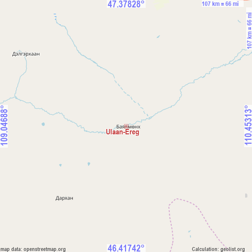
Ulaan-Ereg GPS coordinates[2]
46° 54' 0" North, 109° 45' 0" East
| Map corner | latitude | longitude |
|---|---|---|
| Upper-left | 47.37828°, | 109.04688° |
| Center: | 46.9°, | 109.75° |
| Lower-right: | 46.41742°, | 110.45313° |
| Map W x H: | 106.8×106.8 km | = 66.4×66.4mi |
| max Lat: | 51.50725° ⇑64.1% North |
| Ulaan-Ereg: | 46.9° |
| min Lat: | ⇓35.9% South 42.84199° |
| min Long | Ulaan-Ereg | max Long |
| 89.14358° | 109.75° | 118.51014° |
| W 85.6%⇐ | ⇒14.4% E |
Elevation
Elevation of Ulaan-Ereg is 1109 m = 3638 ft, and this is 307.5 m = 1009 ft below average elevation for this country.
| Max E: |
2800 m = 9186 ft | 74.2% |
| Avg. | 1416.5 m = 4647 ft | |
| Ulaan-Ereg | 1109 m = 3638 ft | |
Min E: |
619 m = 2031 ft | 25.8% |
See also: Mongolia elevation on elevation.city.
Geographical zone
Ulaan-Ereg is located in North temperate zone (between Tropic of Cancer and the Arctic Circle). Distance of this North polar circle is 2186.4 km =1358.6 mi to North.| Distance of | km | miles | from Ulaan-Ereg |
|---|---|---|---|
| North Pole | 4792.3 | 2977.8 | to North |
| Arctic Circle | 2186.4 | 1358.6 | to North |
| Tropic Cancer | 2608.9 | 1621.1 | to South |
| Equator | 5214.8 | 3240.3 | to South |


Nearby cities:
15 places around Ulaan-Ereg: (largest is in red/bold)
• Avraga
52.6 km =32.7 mi,  306°
306°
• Bayan
79 km =49.1 mi,  156°
156°
• Bayan
86.1 km =53.5 mi,  69°
69°
• Bayanbulag
108.2 km =67.2 mi,  6°
6°
• Bayantal
116.4 km =72.3 mi,  251°
251°
• Bayasgalant
117.1 km =72.8 mi,  285°
285°
• Buyant
109.9 km =68.3 mi,  131°
131°
• Choyr
121.8 km =75.7 mi,  240°
240°
• Darhan
40.5 km =25.2 mi,  218°
218°
• Herlen
76.2 km =47.3 mi,  54°
54°
• Modot
108.2 km =67.2 mi,  330°
330°
• Mörön
68.7 km =42.7 mi,  38°
38°
• Shiveegovĭ
123.6 km =76.8 mi, 224°
• Tsomog
121.2 km =75.3 mi,  205°
205°
• Undurkhaan
82.9 km =51.5 mi,  55°
55°
Sources, notices
• [Note1] Compared only with cities in Mongolia existing in our database
• [Src1] Map data: © OpenStreetMap contributors (CC-BY-SA)
• [Src2] Other city data from geonames.org with taken over terms of usage.
• [Src3] Geographical zone / Annual Mean Temperature by Robert A. Rohde @ Wikipedia
