Jargalant geodata
Jargalant (Govĭ-Altay) is a seat of a second-order administrative division; located in Mongolia in Asia/Hovd (GMT+7) time zone. In our database, there are 33 cities with bigger population. Compared to other cities in Mongolia, 84% of cities are located further ↑North; 75.8% of cities are located further →East and 51.8% of cities have higher elevation than Jargalant. Note1


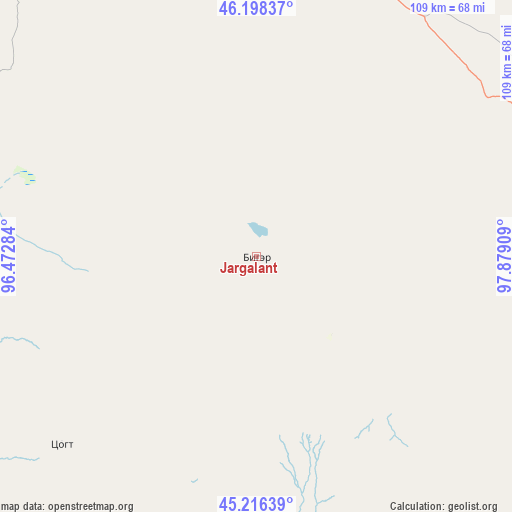
Jargalant GPS coordinates[2]
45° 42' 34.344" North, 97° 10' 33.456" East
| Map corner | latitude | longitude |
|---|---|---|
| Upper-left | 46.19837°, | 96.47284° |
| Center: | 45.70954°, | 97.17596° |
| Lower-right: | 45.21639°, | 97.87909° |
| Map W x H: | 109.2×109.2 km | = 67.9×67.9mi |
| max Lat: | 51.50725° ⇑84% North |
| Jargalant: | 45.70954° |
| min Lat: | ⇓16% South 42.84199° |
| min Long | Jargalant | max Long |
| 89.14358° | 97.17596° | 118.51014° |
| W 24.2%⇐ | ⇒75.8% E |
Elevation
Elevation of Jargalant is 1352 m = 4436 ft, and this is 64.5 m = 212 ft below average elevation for this country.
| Max E: |
2800 m = 9186 ft | 51.8% |
| Avg. | 1416.5 m = 4647 ft | |
| Jargalant | 1352 m = 4436 ft | |
Min E: |
619 m = 2031 ft | 48.2% |
See also: Mongolia elevation on elevation.city.
Geographical zone
Jargalant is located in North temperate zone (between Tropic of Cancer and the Arctic Circle). Distance of this North polar circle is 2318.7 km =1440.8 mi to North.| Distance of | km | miles | from Jargalant |
|---|---|---|---|
| North Pole | 4924.6 | 3060 | to North |
| Arctic Circle | 2318.7 | 1440.8 | to North |
| Tropic Cancer | 2476.5 | 1538.8 | to South |
| Equator | 5082.4 | 3158.1 | to South |


Nearby cities:
15 places around Jargalant: (largest is in red/bold)
• Altai
102.2 km =63.5 mi,  316°
316°
• Balgatay
132.4 km =82.3 mi,  359°
359°
• Bayanbulag
141.1 km =87.7 mi,  29°
29°
• Bulgan
154.7 km =96.1 mi,  131°
131°
• Buyant
127.7 km =79.3 mi,  66°
66°
• Delgermörön
115.8 km =72 mi,  47°
47°
• Haliun
82.3 km =51.1 mi,  287°
287°
• Sangiyn Dalay
78.2 km =48.6 mi,  145°
145°
• Sharga
159.3 km =99 mi, 292°
• Tahilt
57.7 km =35.9 mi,  225°
225°
• Talshand
75.5 km =46.9 mi,  123°
123°
• Taygan
73.1 km =45.4 mi,  11°
11°
• Tsagaan-Olom
122.3 km =76 mi,  335°
335°
• Tsagaanchuluut
160.7 km =99.9 mi,  346°
346°
• Tseel
103 km =64 mi,  261°
261°
Sources, notices
• [Note1] Compared only with cities in Mongolia existing in our database
• [Src1] Map data: © OpenStreetMap contributors (CC-BY-SA)
• [Src2] Other city data from geonames.org with taken over terms of usage.
• [Src3] Geographical zone / Annual Mean Temperature by Robert A. Rohde @ Wikipedia
