Tsagaan-Olom geodata
Tsagaan-Olom (Govĭ-Altay) is a seat of a second-order administrative division; located in Mongolia in Asia/Hovd (GMT+7) time zone. In our database, there are 33 cities with bigger population. Compared to other cities in Mongolia, 66.9% of cities are located further ↑North; 78.8% of cities are located further →East and 72.1% of cities have lower elevation than Tsagaan-Olom. Note1


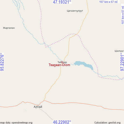
Tsagaan-Olom GPS coordinates[2]
46° 42' 47.772" North, 96° 31' 33.168" East
| Map corner | latitude | longitude |
|---|---|---|
| Upper-left | 47.19321°, | 95.82276° |
| Center: | 46.71327°, | 96.52588° |
| Lower-right: | 46.22902°, | 97.22901° |
| Map W x H: | 107.2×107.2 km | = 66.6×66.6mi |
| max Lat: | 51.50725° ⇑66.9% North |
| Tsagaan-Olom: | 46.71327° |
| min Lat: | ⇓33.1% South 42.84199° |
| min Long | Tsagaan-Olom | max Long |
| 89.14358° | 96.52588° | 118.51014° |
| W 21.2%⇐ | ⇒78.8% E |
Elevation
Elevation of Tsagaan-Olom is 1645 m = 5397 ft, and this is 228.5 m = 750 ft above average elevation for this country.
| Max E: |
2800 m = 9186 ft | 27.9% |
| Tsagaan-Olom | 1645 m 5397 ft | |
| Avg. | 1416.5 m = 4647 ft | |
Min E: |
619 m = 2031 ft | 72.1% |
See also: Mongolia elevation on elevation.city.
Geographical zone
Tsagaan-Olom is located in North temperate zone (between Tropic of Cancer and the Arctic Circle). Distance of this North polar circle is 2207.1 km =1371.4 mi to North.| Distance of | km | miles | from Tsagaan-Olom |
|---|---|---|---|
| North Pole | 4813 | 2990.7 | to North |
| Arctic Circle | 2207.1 | 1371.4 | to North |
| Tropic Cancer | 2588.1 | 1608.2 | to South |
| Equator | 5194 | 3227.4 | to South |


Nearby cities:
15 places around Tsagaan-Olom: (largest is in red/bold)
• Aldar
103.3 km =64.2 mi,  0°
0°
• Altai
43.1 km =26.8 mi,  208°
208°
• Balgatay
51.8 km =32.2 mi,  66°
66°
• Bayan
105.5 km =65.6 mi,  287°
287°
• Bayanbulag
119.6 km =74.3 mi,  84°
84°
• Buyanbat
54.4 km =33.8 mi,  302°
302°
• Buyant
99 km =61.5 mi,  55°
55°
• Haliun
91.5 km =56.9 mi,  197°
197°
• Jargalant
122.3 km =76 mi,  155°
155°
• Sharga
109.3 km =67.9 mi,  241°
241°
• Shiree
89.6 km =55.7 mi,  13°
13°
• Taygan
75.7 km =47 mi,  121°
121°
• Tsagaanchuluut
45.7 km =28.4 mi, 14°
• Tseel
137.2 km =85.3 mi, 201°
• Uliastay
116.8 km =72.6 mi, 11°
Sources, notices
• [Note1] Compared only with cities in Mongolia existing in our database
• [Src1] Map data: © OpenStreetMap contributors (CC-BY-SA)
• [Src2] Other city data from geonames.org with taken over terms of usage.
• [Src3] Geographical zone / Annual Mean Temperature by Robert A. Rohde @ Wikipedia
