Höhtolgoy geodata
Höhtolgoy (Uvs) is a seat of a second-order administrative division; located in Mongolia in Asia/Hovd (GMT+7) time zone. In our database, there are 33 cities with bigger population. Compared to other cities in Mongolia, 83.1% of cities are located further ↓South; 96% of cities are located further →East and 52.5% of cities have lower elevation than Höhtolgoy. Note1


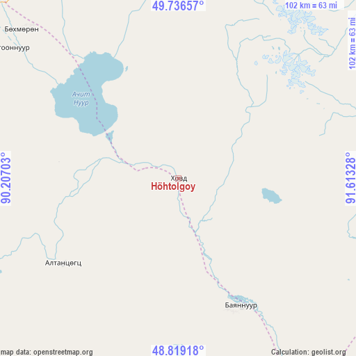
Höhtolgoy GPS coordinates[2]
49° 16' 48.036" North, 90° 54' 36.54" East
| Map corner | latitude | longitude |
|---|---|---|
| Upper-left | 49.73657°, | 90.20703° |
| Center: | 49.28001°, | 90.91015° |
| Lower-right: | 48.81918°, | 91.61328° |
| Map W x H: | 102×102 km | = 63.4×63.4mi |
| max Lat: | 51.50725° ⇑16.9% North |
| Höhtolgoy: | 49.28001° |
| min Lat: | ⇓83.1% South 42.84199° |
| min Long | Höhtolgoy | max Long |
| 89.14358° | 90.91015° | 118.51014° |
| W 4%⇐ | ⇒96% E |
Elevation
Elevation of Höhtolgoy is 1404 m = 4606 ft, and this is 12.5 m = 41 ft below average elevation for this country.
| Max E: |
2800 m = 9186 ft | 47.5% |
| Avg. | 1416.5 m = 4647 ft | |
| Höhtolgoy | 1404 m = 4606 ft | |
Min E: |
619 m = 2031 ft | 52.5% |
See also: Mongolia elevation on elevation.city.
Geographical zone
Höhtolgoy is located in North temperate zone (between Tropic of Cancer and the Arctic Circle). Distance of this North polar circle is 1921.8 km =1194.2 mi to North.| Distance of | km | miles | from Höhtolgoy |
|---|---|---|---|
| North Pole | 4527.6 | 2813.3 | to North |
| Arctic Circle | 1921.8 | 1194.2 | to North |
| Tropic Cancer | 2873.5 | 1785.5 | to South |
| Equator | 5479.4 | 3404.7 | to South |


Nearby cities:
15 places around Höhtolgoy: (largest is in red/bold)
• Bayshint
62.4 km =38.8 mi,  313°
313°
• Bilüü
110.2 km =68.5 mi,  256°
256°
• Buga
76.8 km =47.7 mi,  241°
241°
• Har-Us
86.2 km =53.6 mi,  108°
108°
• Har-Us
96.5 km =60 mi,  156°
156°
• Harhiraa
90.7 km =56.4 mi,  52°
52°
• Havtsal
106.2 km =66 mi,  30°
30°
• Namir
61.8 km =38.4 mi, 108°
• Naranbulag
120.4 km =74.8 mi,  85°
85°
• Nogoonnuur
61.1 km =38 mi, 307°
• Tolbo
106.4 km =66.1 mi,  205°
205°
• Tsagaantüngi
42.1 km =26.2 mi,  232°
232°
• Ulaangom
114.1 km =70.9 mi, 46°
• Uujim
103.2 km =64.1 mi,  245°
245°
• Ölgii
77.2 km =48 mi, 243°
Sources, notices
• [Note1] Compared only with cities in Mongolia existing in our database
• [Src1] Map data: © OpenStreetMap contributors (CC-BY-SA)
• [Src2] Other city data from geonames.org with taken over terms of usage.
• [Src3] Geographical zone / Annual Mean Temperature by Robert A. Rohde @ Wikipedia
