Xicotepec de Juárez geodata
Xicotepec de Juárez (Puebla) is a populated place; located in Mexico in America/Mexico_City (GMT-6) time zone. With population of 39,803 people, there are 265 cities with bigger population in this country. Compared to other cities in Mexico, 63.1% of cities are located further ↓South; 64.1% of cities are located further ←West and 55.8% of cities have higher elevation than Xicotepec de Juárez. Note1


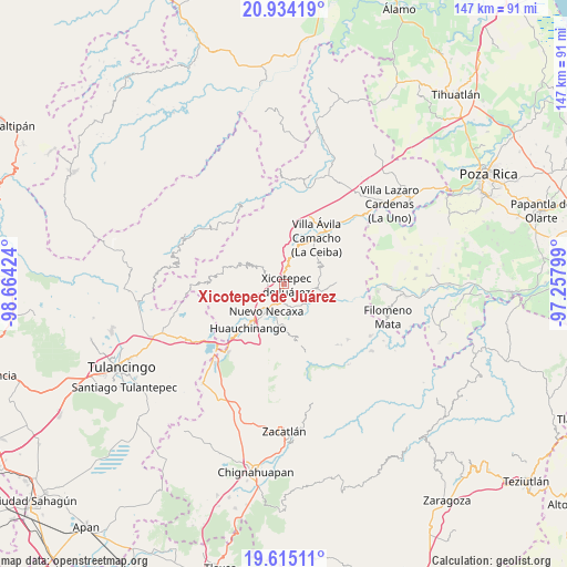
Xicotepec de Juárez GPS coordinates[2]
20° 16' 33.78" North, 97° 57' 39.996" West
| Map corner | latitude | longitude |
|---|---|---|
| Upper-left | 20.93419°, | -98.66424° |
| Center: | 20.27605°, | -97.96111° |
| Lower-right: | 19.61511°, | -97.25799° |
| Map W x H: | 146.7×146.7 km | = 91.2×91.2mi |
| max Lat: | 32.7° ⇑36.9% North |
| Xicotepec de Juárez: | 20.27605° |
| min Lat: | ⇓63.1% South 14.53588° |
| min Long | Xicotepec de Ju | max Long |
| -117.105° | -97.96111° | -86.73105° |
| W 64.1%⇐ | ⇒35.9% E |
Elevation
Elevation of Xicotepec de Juárez is 1167 m = 3829 ft, and this is 86.7 m = 284 ft below average elevation for this country.
| Max E: |
3497 m = 11473 ft | 55.8% |
| Avg. | 1253.7 m = 4113 ft | |
| Xicotepec de Juárez | 1167 m = 3829 ft | |
Min E: |
-1 m = -3 ft | 44.2% |
See also: Mexico elevation on elevation.city.
Geographical zone
Xicotepec de Juárez is located in North Torrid zone (between Equator and Tropic of Cancer). Distance of this Northern Tropic circle is 351.4 km =218.3 mi to North.| Distance of | km | miles | from Xicotepec de Juárez |
|---|---|---|---|
| North Pole | 7752.6 | 4817.2 | to North |
| Arctic Circle | 5146.7 | 3198 | to North |
| Tropic Cancer | 351.4 | 218.3 | to North |
| Equator | 2254.5 | 1400.9 | to South |


Nearby cities:
15 places around Xicotepec de Juárez: (largest is in red/bold)
• Ahuaxintitla
7.3 km =4.5 mi,  110°
110°
• Atequexquitla
7.4 km =4.6 mi,  100°
100°
• Duraznotla
2.3 km =1.4 mi,  226°
226°
• Itzatlán
7 km =4.3 mi,  339°
339°
• Lagunillas
6 km =3.7 mi,  163°
163°
• Lomas Verdes
2 km =1.2 mi,  141°
141°
• Los Pinos
6.4 km =4 mi,  152°
152°
• Mazacoatlán
7 km =4.3 mi, 143°
• Morelos
2.8 km =1.7 mi,  134°
134°
• Necaxaltépetl
5.9 km =3.7 mi,  218°
218°
• San Antonio Ocopetlatlán
3.6 km =2.2 mi, 154°
• San Isidro
2.9 km =1.8 mi,  180°
180°
• San Pedro Itztla
2.8 km =1.7 mi,  93°
93°
• Tepetzintla de Galeana
6.5 km =4 mi,  273°
273°
• Tierra Negra
3.7 km =2.3 mi,  172°
172°
Sources, notices
• [Note1] Compared only with cities in Mexico existing in our database
• [Src1] Map data: © OpenStreetMap contributors (CC-BY-SA)
• [Src2] Other city data from geonames.org with taken over terms of usage.
• [Src3] Geographical zone / Annual Mean Temperature by Robert A. Rohde @ Wikipedia
