Tlaltepango geodata
Tlaltepango (Puebla) is a populated place; located in Mexico in America/Mexico_City (GMT-6) time zone. With population of 1,756 people, there are 4942 cities with bigger population in this country. Compared to other cities in Mexico, 60.1% of cities are located further ↓South; 65.1% of cities are located further ←West and 52.4% of cities have higher elevation than Tlaltepango. Note1


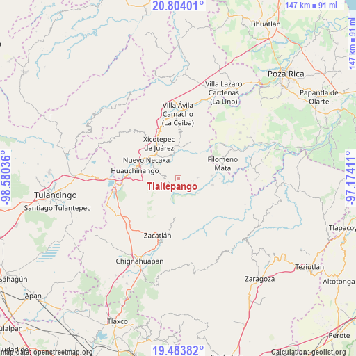
Tlaltepango GPS coordinates[2]
20° 8' 43.116" North, 97° 52' 38.028" West
| Map corner | latitude | longitude |
|---|---|---|
| Upper-left | 20.80401°, | -98.58036° |
| Center: | 20.14531°, | -97.87723° |
| Lower-right: | 19.48382°, | -97.17411° |
| Map W x H: | 146.8×146.8 km | = 91.2×91.2mi |
| max Lat: | 32.7° ⇑39.9% North |
| Tlaltepango: | 20.14531° |
| min Lat: | ⇓60.1% South 14.53588° |
| min Long | Tlaltepango | max Long |
| -117.105° | -97.87723° | -86.73105° |
| W 65.1%⇐ | ⇒34.9% E |
Elevation
Elevation of Tlaltepango is 1318 m = 4324 ft, and this is 64.3 m = 211 ft above average elevation for this country.
| Max E: |
3497 m = 11473 ft | 52.4% |
| Tlaltepango | 1318 m 4324 ft | |
| Avg. | 1253.7 m = 4113 ft | |
Min E: |
-1 m = -3 ft | 47.6% |
See also: Mexico elevation on elevation.city.
Geographical zone
Tlaltepango is located in North Torrid zone (between Equator and Tropic of Cancer). Distance of this Northern Tropic circle is 366 km =227.4 mi to North.| Distance of | km | miles | from Tlaltepango |
|---|---|---|---|
| North Pole | 7767.1 | 4826.3 | to North |
| Arctic Circle | 5161.2 | 3207 | to North |
| Tropic Cancer | 366 | 227.4 | to North |
| Equator | 2239.9 | 1391.8 | to South |


Nearby cities:
15 places around Tlaltepango: (largest is in red/bold)
• Ahuacatlaya
6.3 km =3.9 mi,  54°
54°
• Chicahuaxtla
7.1 km =4.4 mi,  267°
267°
• Chiconcuautla
8.5 km =5.3 mi,  229°
229°
• Cutzontipa
4.7 km =2.9 mi,  217°
217°
• El Encinal
9 km =5.6 mi,  19°
19°
• La Cruz
6.2 km =3.9 mi,  99°
99°
• La Cumbre
3.8 km =2.4 mi,  139°
139°
• Quamila
4.9 km =3 mi,  298°
298°
• Telolotla
8.3 km =5.2 mi,  334°
334°
• Tlamaya Chico
5.2 km =3.2 mi, 103°
• Tlamaya Grande
7.7 km =4.8 mi,  88°
88°
• Tlaola
4.8 km =3 mi,  261°
261°
• Tlapacoya
3.8 km =2.4 mi,  131°
131°
• Tlatlapanala
6.2 km =3.9 mi, 300°
• Xochinanacatlán
5.9 km =3.7 mi,  338°
338°
Sources, notices
• [Note1] Compared only with cities in Mexico existing in our database
• [Src1] Map data: © OpenStreetMap contributors (CC-BY-SA)
• [Src2] Other city data from geonames.org with taken over terms of usage.
• [Src3] Geographical zone / Annual Mean Temperature by Robert A. Rohde @ Wikipedia
