Tlaola geodata
Tlaola (Puebla) is a populated place; located in Mexico in America/Mexico_City (GMT-6) time zone. With population of 1,406 people, there are 6155 cities with bigger population in this country. Compared to other cities in Mexico, 60% of cities are located further ↓South; 64.5% of cities are located further ←West and 55.7% of cities have higher elevation than Tlaola. Note1


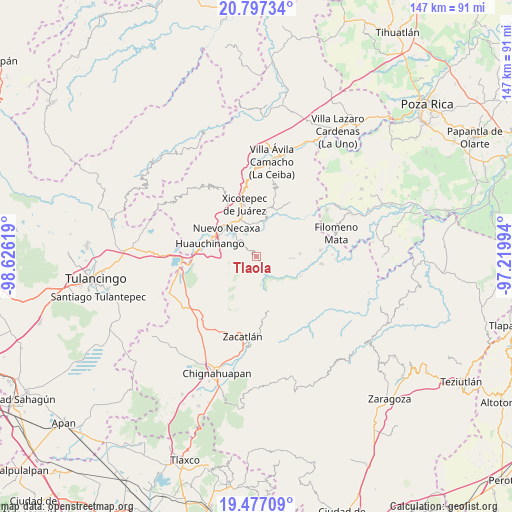
Tlaola GPS coordinates[2]
20° 8' 18.996" North, 97° 55' 23.016" West
| Map corner | latitude | longitude |
|---|---|---|
| Upper-left | 20.79734°, | -98.62619° |
| Center: | 20.13861°, | -97.92306° |
| Lower-right: | 19.47709°, | -97.21994° |
| Map W x H: | 146.8×146.8 km | = 91.2×91.2mi |
| max Lat: | 32.7° ⇑40% North |
| Tlaola: | 20.13861° |
| min Lat: | ⇓60% South 14.53588° |
| min Long | Tlaola | max Long |
| -117.105° | -97.92306° | -86.73105° |
| W 64.5%⇐ | ⇒35.5% E |
Elevation
Elevation of Tlaola is 1169 m = 3835 ft, and this is 84.7 m = 278 ft below average elevation for this country.
| Max E: |
3497 m = 11473 ft | 55.7% |
| Avg. | 1253.7 m = 4113 ft | |
| Tlaola | 1169 m = 3835 ft | |
Min E: |
-1 m = -3 ft | 44.3% |
See also: Mexico elevation on elevation.city.
Geographical zone
Tlaola is located in North Torrid zone (between Equator and Tropic of Cancer). Distance of this Northern Tropic circle is 366.7 km =227.9 mi to North.| Distance of | km | miles | from Tlaola |
|---|---|---|---|
| North Pole | 7767.9 | 4826.7 | to North |
| Arctic Circle | 5162 | 3207.5 | to North |
| Tropic Cancer | 366.7 | 227.9 | to North |
| Equator | 2239.2 | 1391.4 | to South |


Nearby cities:
15 places around Tlaola: (largest is in red/bold)
• Chicahuaxtla
2.4 km =1.5 mi,  280°
280°
• Chiconcuautla
5.1 km =3.2 mi,  198°
198°
• Cuetzalingo
7.6 km =4.7 mi,  179°
179°
• Cutzontipa
3.6 km =2.2 mi,  147°
147°
• La Cumbre
7.5 km =4.7 mi,  106°
106°
• Palzoquitla
6 km =3.7 mi,  245°
245°
• Quamila
3.1 km =1.9 mi,  8°
8°
• San Lorenzo Tlaxipehuala
5.4 km =3.4 mi,  260°
260°
• Tlalmaya
6.8 km =4.2 mi,  288°
288°
• Tlaltenango
4.6 km =2.9 mi,  239°
239°
• Tlaltepango
4.8 km =3 mi,  81°
81°
• Tlatlapanala
3.9 km =2.4 mi,  351°
351°
• Tzitzicazapa
7.4 km =4.6 mi, 347°
• Xaltepuxtla
6.6 km =4.1 mi,  308°
308°
• Xochinanacatlán
6.8 km =4.2 mi,  22°
22°
Sources, notices
• [Note1] Compared only with cities in Mexico existing in our database
• [Src1] Map data: © OpenStreetMap contributors (CC-BY-SA)
• [Src2] Other city data from geonames.org with taken over terms of usage.
• [Src3] Geographical zone / Annual Mean Temperature by Robert A. Rohde @ Wikipedia
