Tlacuilotepec geodata
Tlacuilotepec (Puebla) is a seat of a second-order administrative division; located in Mexico in America/Mexico_City (GMT-6) time zone. With population of 1,685 people, there are 5153 cities with bigger population in this country. Compared to other cities in Mexico, 64% of cities are located further ↓South; 62.8% of cities are located further ←West and 52.7% of cities have higher elevation than Tlacuilotepec. Note1


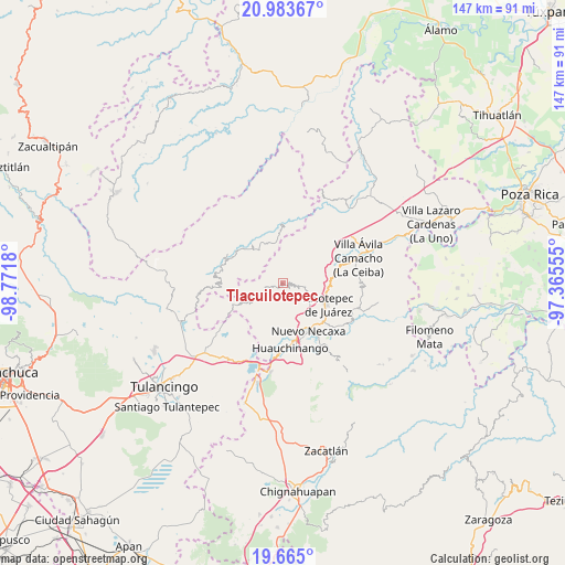
Tlacuilotepec GPS coordinates[2]
20° 19' 32.664" North, 98° 4' 7.212" West
| Map corner | latitude | longitude |
|---|---|---|
| Upper-left | 20.98367°, | -98.7718° |
| Center: | 20.32574°, | -98.06867° |
| Lower-right: | 19.665°, | -97.36555° |
| Map W x H: | 146.6×146.6 km | = 91.1×91.1mi |
| max Lat: | 32.7° ⇑36% North |
| Tlacuilotepec: | 20.32574° |
| min Lat: | ⇓64% South 14.53588° |
| min Long | Tlacuilotepec | max Long |
| -117.105° | -98.06867° | -86.73105° |
| W 62.8%⇐ | ⇒37.2% E |
Elevation
Elevation of Tlacuilotepec is 1303 m = 4275 ft, and this is 49.3 m = 162 ft above average elevation for this country.
| Max E: |
3497 m = 11473 ft | 52.7% |
| Tlacuilotepec | 1303 m 4275 ft | |
| Avg. | 1253.7 m = 4113 ft | |
Min E: |
-1 m = -3 ft | 47.3% |
See also: Mexico elevation on elevation.city.
Geographical zone
Tlacuilotepec is located in North Torrid zone (between Equator and Tropic of Cancer). Distance of this Northern Tropic circle is 345.9 km =214.9 mi to North.| Distance of | km | miles | from Tlacuilotepec |
|---|---|---|---|
| North Pole | 7747.1 | 4813.8 | to North |
| Arctic Circle | 5141.2 | 3194.6 | to North |
| Tropic Cancer | 345.9 | 214.9 | to North |
| Equator | 2260 | 1404.3 | to South |


Nearby cities:
15 places around Tlacuilotepec: (largest is in red/bold)
• Acalapa
2.8 km =1.7 mi,  243°
243°
• Atla
8.1 km =5 mi,  226°
226°
• Copila
6.1 km =3.8 mi,  194°
194°
• Cuauneutla de la Paz
3.8 km =2.4 mi,  250°
250°
• Cuautepec
3.1 km =1.9 mi,  62°
62°
• Cuaxtla
5.3 km =3.3 mi,  355°
355°
• Cueyatla
4.1 km =2.5 mi,  202°
202°
• El Jericó
7.5 km =4.7 mi,  66°
66°
• El Álamo
6.1 km =3.8 mi,  27°
27°
• Ozomatlán
6 km =3.7 mi,  147°
147°
• Santa María
1.9 km =1.2 mi,  127°
127°
• Tepetzintla de Galeana
6.9 km =4.3 mi,  137°
137°
• Tlalcruz de Libres
5.1 km =3.2 mi, 242°
• Tlapehuala
4.4 km =2.7 mi,  109°
109°
• Zoyatla de Guerrero
6.9 km =4.3 mi, 246°
Sources, notices
• [Note1] Compared only with cities in Mexico existing in our database
• [Src1] Map data: © OpenStreetMap contributors (CC-BY-SA)
• [Src2] Other city data from geonames.org with taken over terms of usage.
• [Src3] Geographical zone / Annual Mean Temperature by Robert A. Rohde @ Wikipedia
