Congreso Permanente Agrario geodata
Congreso Permanente Agrario (Hidalgo) is a populated place; located in Mexico in America/Mexico_City (GMT-6) time zone. With population of 632 people, there are 13699 cities with bigger population in this country. Compared to other cities in Mexico, 78.4% of cities are located further ↓South; 59.9% of cities are located further ←West and 78.3% of cities have higher elevation than Congreso Permanente Agrario. Note1
Current local time in Congreso Permanente Agrario:
06:50 AM, WednesdayDifference from your time zone: hours


Congreso Permanente Agrario GPS coordinates[2]
21° 8' 5.208" North, 98° 17' 55.032" West
| Map corner | latitude | longitude |
|---|---|---|
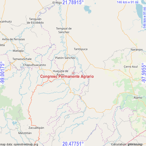
| Upper-left | 21.78915°, | -99.00175° |
| Center: | 21.13478°, | -98.29862° |
| Lower-right: | 20.47751°, | -97.5955° |
| Map W x H: | 145.8×145.8 km | = 90.6×90.6mi |
| max Lat: | 32.7° ⇑21.6% North |
| Congreso Permanente Agrario: | 21.13478° |
| min Lat: | ⇓78.4% South 14.53588° |
| min Long | Congreso Perman | max Long |
| -117.105° | -98.29862° | -86.73105° |
| W 59.9%⇐ | ⇒40.1% E |
Elevation
Elevation of Congreso Permanente Agrario is 125 m = 410 ft, and this is 1128.7 m = 3703 ft below average elevation for this country.
| Max E: |
3497 m = 11473 ft | 78.3% |
| Avg. | 1253.7 m = 4113 ft | |
| Congreso Permanente Agrario | 125 m = 410 ft | |
Min E: |
-1 m = -3 ft | 21.7% |
See also: Mexico elevation on elevation.city.
Geographical zone
Congreso Permanente Agrario is located in North Torrid zone (between Equator and Tropic of Cancer). Distance of this Northern Tropic circle is 256 km =159.1 mi to North.| Distance of | km | miles | from Congreso Permanente Agrario |
|---|---|---|---|
| North Pole | 7657.1 | 4757.9 | to North |
| Arctic Circle | 5051.2 | 3138.7 | to North |
| Tropic Cancer | 256 | 159.1 | to North |
| Equator | 2350 | 1460.2 | to South |


Nearby cities:
15 places around Congreso Permanente Agrario: (largest is in red/bold)
• Ahuatempa
9.6 km =6 mi,  245°
245°
• Ahuehuetl
9.8 km =6.1 mi,  171°
171°
• Chalahuiyapa
7 km =4.3 mi,  284°
284°
• Chalingo
9.1 km =5.7 mi,  115°
115°
• Chapopote Chico
5.3 km =3.3 mi,  87°
87°
• Corral Blanco (Todos por Hidalgo)
9.5 km =5.9 mi, 282°
• Los Otates
5.2 km =3.2 mi,  289°
289°
• Los Puentes
10.6 km =6.6 mi,  187°
187°
• Motoltepec
7.9 km =4.9 mi,  296°
296°
• Parque de Poblamiento Solidaridad
9.3 km =5.8 mi, 281°
• Rancho Viejo
3.7 km =2.3 mi,  327°
327°
• Santa Catarina
9.3 km =5.8 mi, 245°
• Tenexco II
9.5 km =5.9 mi,  215°
215°
• Tlacuapan
10 km =6.2 mi, 185°
• Tzacuala
7.9 km =4.9 mi,  112°
112°
Sources, notices
• [Note1] Compared only with cities in Mexico existing in our database
• [Src1] Map data: © OpenStreetMap contributors (CC-BY-SA)
• [Src2] Other city data from geonames.org with taken over terms of usage.
• [Src3] Geographical zone / Annual Mean Temperature by Robert A. Rohde @ Wikipedia
