Santa Isabel Chalma geodata
Santa Isabel Chalma (State of Mexico) is a populated place; located in Mexico in America/Mexico_City (GMT-6) time zone. With population of 2,215 people, there are 3962 cities with bigger population in this country. Compared to other cities in Mexico, 62% of cities are located further ↑North; 54.2% of cities are located further ←West and 92% of cities have lower elevation than Santa Isabel Chalma. Note1


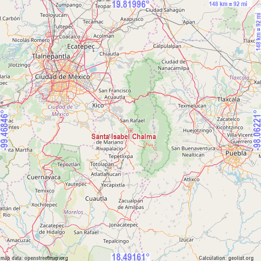
Santa Isabel Chalma GPS coordinates[2]
19° 9' 25.632" North, 98° 45' 55.188" West
| Map corner | latitude | longitude |
|---|---|---|
| Upper-left | 19.81996°, | -99.46846° |
| Center: | 19.15712°, | -98.76533° |
| Lower-right: | 18.49161°, | -98.06221° |
| Map W x H: | 147.7×147.7 km | = 91.8×91.8mi |
| max Lat: | 32.7° ⇑62% North |
| Santa Isabel Chalma: | 19.15712° |
| min Lat: | ⇓38% South 14.53588° |
| min Long | Santa Isabel Ch | max Long |
| -117.105° | -98.76533° | -86.73105° |
| W 54.2%⇐ | ⇒45.8% E |
Elevation
Elevation of Santa Isabel Chalma is 2483 m = 8146 ft, and this is 1229.3 m = 4033 ft above average elevation for this country.
| Max E: |
3497 m = 11473 ft | 8% |
| Santa Isabel Chalma | 2483 m 8146 ft | |
| Avg. | 1253.7 m = 4113 ft | |
Min E: |
-1 m = -3 ft | 92% |
See also: Mexico elevation on elevation.city.
Geographical zone
Santa Isabel Chalma is located in North Torrid zone (between Equator and Tropic of Cancer). Distance of this Northern Tropic circle is 475.8 km =295.6 mi to North.| Distance of | km | miles | from Santa Isabel Chalma |
|---|---|---|---|
| North Pole | 7877 | 4894.5 | to North |
| Arctic Circle | 5271.1 | 3275.3 | to North |
| Tropic Cancer | 475.8 | 295.6 | to North |
| Equator | 2130.1 | 1323.6 | to South |


Nearby cities:
15 places around Santa Isabel Chalma: (largest is in red/bold)
• Amecameca
3.7 km =2.3 mi,  181°
181°
• Ayapango
4.9 km =3 mi,  227°
227°
• La Colonia
2.6 km =1.6 mi,  237°
237°
• Mihuacan
7.1 km =4.4 mi,  220°
220°
• Pahuacán
7 km =4.3 mi, 217°
• Poxtla
4 km =2.5 mi, 237°
• San Antonio Tlaltecahuacán
0.4 km =0.2 mi,  283°
283°
• San Diego Chalcatepehuacán
3.9 km =2.4 mi,  202°
202°
• San Diego Huehuecalco
7.2 km =4.5 mi, 178°
• San Rafael
5.9 km =3.7 mi,  9°
9°
• Santiago Cuautenco
2.2 km =1.4 mi,  117°
117°
• Santo Tomás Atzingo
2.2 km =1.4 mi,  320°
320°
• Tlalmanalco
6.5 km =4 mi, 324°
• Tlamapa
7.6 km =4.7 mi,  256°
256°
• Zentlalpan
2.2 km =1.4 mi,  249°
249°
Sources, notices
• [Note1] Compared only with cities in Mexico existing in our database
• [Src1] Map data: © OpenStreetMap contributors (CC-BY-SA)
• [Src2] Other city data from geonames.org with taken over terms of usage.
• [Src3] Geographical zone / Annual Mean Temperature by Robert A. Rohde @ Wikipedia
