San Rafael geodata
San Rafael (State of Mexico) is a populated place; located in Mexico in America/Mexico_City (GMT-6) time zone. With population of 20,873 people, there are 488 cities with bigger population in this country. Compared to other cities in Mexico, 60.9% of cities are located further ↑North; 54.3% of cities are located further ←West and 93.5% of cities have lower elevation than San Rafael. Note1


San Rafael GPS coordinates[2]
19° 12' 34.524" North, 98° 45' 22.896" West
| Map corner | latitude | longitude |
|---|---|---|
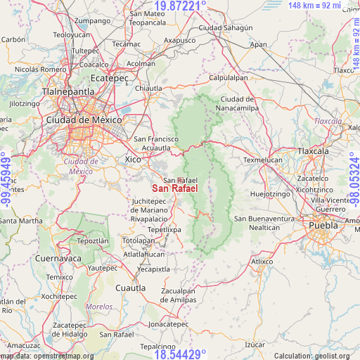
| Upper-left | 19.87221°, | -99.45949° |
| Center: | 19.20959°, | -98.75636° |
| Lower-right: | 18.54429°, | -98.05324° |
| Map W x H: | 147.7×147.7 km | = 91.8×91.8mi |
| max Lat: | 32.7° ⇑60.9% North |
| San Rafael: | 19.20959° |
| min Lat: | ⇓39.1% South 14.53588° |
| min Long | San Rafael | max Long |
| -117.105° | -98.75636° | -86.73105° |
| W 54.3%⇐ | ⇒45.7% E |
Elevation
Elevation of San Rafael is 2552 m = 8373 ft, and this is 1298.3 m = 4260 ft above average elevation for this country.
| Max E: |
3497 m = 11473 ft | 6.5% |
| San Rafael | 2552 m 8373 ft | |
| Avg. | 1253.7 m = 4113 ft | |
Min E: |
-1 m = -3 ft | 93.5% |
See also: Mexico elevation on elevation.city.
Geographical zone
San Rafael is located in North Torrid zone (between Equator and Tropic of Cancer). Distance of this Northern Tropic circle is 470 km =292 mi to North.| Distance of | km | miles | from San Rafael |
|---|---|---|---|
| North Pole | 7871.2 | 4890.9 | to North |
| Arctic Circle | 5265.3 | 3271.7 | to North |
| Tropic Cancer | 470 | 292 | to North |
| Equator | 2135.9 | 1327.2 | to South |


Nearby cities:
15 places around San Rafael: (largest is in red/bold)
• Amecameca
9.6 km =6 mi,  186°
186°
• Ejido Atoyac
9.9 km =6.2 mi,  281°
281°
• La Colonia
7.9 km =4.9 mi,  203°
203°
• Miraflores
5.5 km =3.4 mi, 284°
• Poxtla
9.1 km =5.7 mi,  208°
208°
• San Andrés Metla
9 km =5.6 mi, 275°
• San Antonio Tlaltecahuacán
5.9 km =3.7 mi, 192°
• San Diego Chalcatepehuacán
9.7 km =6 mi, 194°
• San Lorenzo Tlalmimilolpan
5.3 km =3.3 mi, 284°
• Santa Isabel Chalma
5.9 km =3.7 mi, 189°
• Santa María Huexoculco
8.6 km =5.3 mi,  308°
308°
• Santiago Cuautenco
6.9 km =4.3 mi,  171°
171°
• Santo Tomás Atzingo
4.7 km =2.9 mi, 209°
• Tlalmanalco
4.7 km =2.9 mi,  264°
264°
• Zentlalpan
7.3 km =4.5 mi, 204°
Sources, notices
• [Note1] Compared only with cities in Mexico existing in our database
• [Src1] Map data: © OpenStreetMap contributors (CC-BY-SA)
• [Src2] Other city data from geonames.org with taken over terms of usage.
• [Src3] Geographical zone / Annual Mean Temperature by Robert A. Rohde @ Wikipedia
