Santiago Cuautenco geodata
Santiago Cuautenco (State of Mexico) is a populated place; located in Mexico in America/Mexico_City (GMT-6) time zone. With population of 1,520 people, there are 5670 cities with bigger population in this country. Compared to other cities in Mexico, 62.2% of cities are located further ↑North; 54.4% of cities are located further ←West and 92.8% of cities have lower elevation than Santiago Cuautenco. Note1


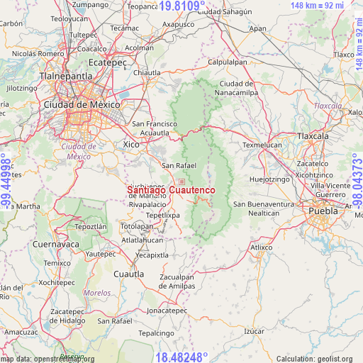
Santiago Cuautenco GPS coordinates[2]
19° 8' 52.908" North, 98° 44' 48.66" West
| Map corner | latitude | longitude |
|---|---|---|
| Upper-left | 19.8109°, | -99.44998° |
| Center: | 19.14803°, | -98.74685° |
| Lower-right: | 18.48248°, | -98.04373° |
| Map W x H: | 147.7×147.7 km | = 91.8×91.8mi |
| max Lat: | 32.7° ⇑62.2% North |
| Santiago Cuautenco: | 19.14803° |
| min Lat: | ⇓37.8% South 14.53588° |
| min Long | Santiago Cuaute | max Long |
| -117.105° | -98.74685° | -86.73105° |
| W 54.4%⇐ | ⇒45.6% E |
Elevation
Elevation of Santiago Cuautenco is 2520 m = 8268 ft, and this is 1266.3 m = 4155 ft above average elevation for this country.
| Max E: |
3497 m = 11473 ft | 7.2% |
| Santiago Cuautenco | 2520 m 8268 ft | |
| Avg. | 1253.7 m = 4113 ft | |
Min E: |
-1 m = -3 ft | 92.8% |
See also: Mexico elevation on elevation.city.
Geographical zone
Santiago Cuautenco is located in North Torrid zone (between Equator and Tropic of Cancer). Distance of this Northern Tropic circle is 476.9 km =296.3 mi to North.| Distance of | km | miles | from Santiago Cuautenco |
|---|---|---|---|
| North Pole | 7878 | 4895.2 | to North |
| Arctic Circle | 5272.1 | 3275.9 | to North |
| Tropic Cancer | 476.9 | 296.3 | to North |
| Equator | 2129.1 | 1323 | to South |


Nearby cities:
15 places around Santiago Cuautenco: (largest is in red/bold)
• Amecameca
3.4 km =2.1 mi,  217°
217°
• Ayapango
6 km =3.7 mi,  247°
247°
• La Colonia
4.2 km =2.6 mi,  264°
264°
• Mihuacan
7.8 km =4.8 mi,  236°
236°
• Pahuacán
7.7 km =4.8 mi,  233°
233°
• Poxtla
5.5 km =3.4 mi, 258°
• San Antonio Tlaltecahuacán
2.6 km =1.6 mi,  295°
295°
• San Diego Chalcatepehuacán
4.3 km =2.7 mi, 232°
• San Diego Huehuecalco
6.4 km =4 mi,  195°
195°
• San Pedro Nexapa
7.2 km =4.5 mi,  171°
171°
• San Rafael
6.9 km =4.3 mi,  351°
351°
• Santa Isabel Chalma
2.2 km =1.4 mi, 297°
• Santo Tomás Atzingo
4.3 km =2.7 mi,  309°
309°
• Zentlalpan
4 km =2.5 mi,  273°
273°
• Zoyatzingo
7.5 km =4.7 mi,  210°
210°
Sources, notices
• [Note1] Compared only with cities in Mexico existing in our database
• [Src1] Map data: © OpenStreetMap contributors (CC-BY-SA)
• [Src2] Other city data from geonames.org with taken over terms of usage.
• [Src3] Geographical zone / Annual Mean Temperature by Robert A. Rohde @ Wikipedia
