La Muralla geodata
La Muralla (Oaxaca) is a populated place; located in Mexico in America/Mexico_City (GMT-6) time zone. With population of 576 people, there are 14877 cities with bigger population in this country. Compared to other cities in Mexico, 94.4% of cities are located further ↑North; 65.6% of cities are located further ←West and 71.5% of cities have higher elevation than La Muralla. Note1


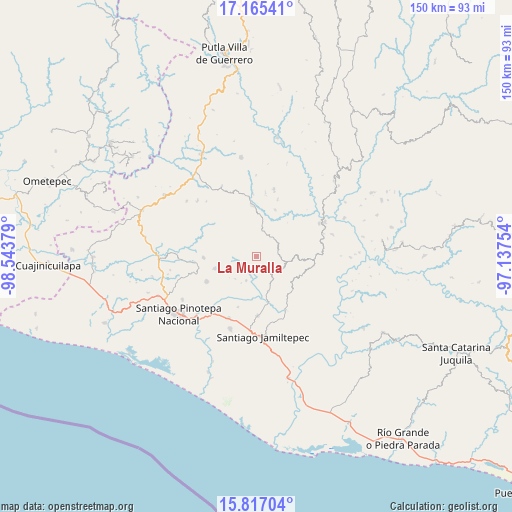
La Muralla GPS coordinates[2]
16° 29' 32.64" North, 97° 50' 26.376" West
| Map corner | latitude | longitude |
|---|---|---|
| Upper-left | 17.16541°, | -98.54379° |
| Center: | 16.4924°, | -97.84066° |
| Lower-right: | 15.81704°, | -97.13754° |
| Map W x H: | 149.9×149.9 km | = 93.1×93.1mi |
| max Lat: | 32.7° ⇑94.4% North |
| La Muralla: | 16.4924° |
| min Lat: | ⇓5.6% South 14.53588° |
| min Long | La Muralla | max Long |
| -117.105° | -97.84066° | -86.73105° |
| W 65.6%⇐ | ⇒34.4% E |
Elevation
Elevation of La Muralla is 349 m = 1145 ft, and this is 904.7 m = 2968 ft below average elevation for this country.
| Max E: |
3497 m = 11473 ft | 71.5% |
| Avg. | 1253.7 m = 4113 ft | |
| La Muralla | 349 m = 1145 ft | |
Min E: |
-1 m = -3 ft | 28.5% |
See also: Mexico elevation on elevation.city.
Geographical zone
La Muralla is located in North Torrid zone (between Equator and Tropic of Cancer). Distance of this Northern Tropic circle is 772.1 km =479.8 mi to North.| Distance of | km | miles | from La Muralla |
|---|---|---|---|
| North Pole | 8173.3 | 5078.7 | to North |
| Arctic Circle | 5567.4 | 3459.4 | to North |
| Tropic Cancer | 772.1 | 479.8 | to North |
| Equator | 1833.8 | 1139.5 | to South |


Nearby cities:
15 places around La Muralla: (largest is in red/bold)
• El Carasol
6.8 km =4.2 mi,  69°
69°
• El Frutillo
7 km =4.3 mi,  89°
89°
• La Reforma
14.7 km =9.1 mi,  358°
358°
• Nuevo Progreso
6.5 km =4 mi,  299°
299°
• San Agustín Chayuco
10.6 km =6.6 mi,  160°
160°
• San Cristóbal
2.8 km =1.7 mi,  250°
250°
• San José de las Flores
14.5 km =9 mi,  133°
133°
• San Juan Colorado
12.6 km =7.8 mi, 253°
• San Juan Yosocani
9.1 km =5.7 mi,  224°
224°
• San Lorenzo
11.4 km =7.1 mi,  198°
198°
• San Miguel Tetepelcingo
12.3 km =7.6 mi,  211°
211°
• Santa María Nutío
6.8 km =4.2 mi,  263°
263°
• Santa María Yosocani
7.6 km =4.7 mi, 203°
• Siniyuvi
9.4 km =5.8 mi, 258°
• Villa Nueva
7.9 km =4.9 mi,  12°
12°
Sources, notices
• [Note1] Compared only with cities in Mexico existing in our database
• [Src1] Map data: © OpenStreetMap contributors (CC-BY-SA)
• [Src2] Other city data from geonames.org with taken over terms of usage.
• [Src3] Geographical zone / Annual Mean Temperature by Robert A. Rohde @ Wikipedia
