Guadalupe del Recreo geodata
Guadalupe del Recreo (Oaxaca) is a populated place; located in Mexico in America/Mexico_City (GMT-6) time zone. With population of 608 people, there are 14173 cities with bigger population in this country. Compared to other cities in Mexico, 80.5% of cities are located further ↑North; 59.5% of cities are located further ←West and 50.6% of cities have lower elevation than Guadalupe del Recreo. Note1


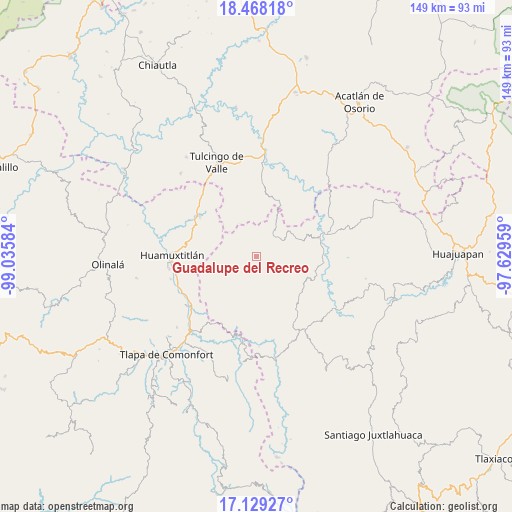
Guadalupe del Recreo GPS coordinates[2]
17° 47' 59.928" North, 98° 19' 57.756" West
| Map corner | latitude | longitude |
|---|---|---|
| Upper-left | 18.46818°, | -99.03584° |
| Center: | 17.79998°, | -98.33271° |
| Lower-right: | 17.12927°, | -97.62959° |
| Map W x H: | 148.9×148.9 km | = 92.5×92.5mi |
| max Lat: | 32.7° ⇑80.5% North |
| Guadalupe del Recreo: | 17.79998° |
| min Lat: | ⇓19.5% South 14.53588° |
| min Long | Guadalupe del R | max Long |
| -117.105° | -98.33271° | -86.73105° |
| W 59.5%⇐ | ⇒40.5% E |
Elevation
Elevation of Guadalupe del Recreo is 1467 m = 4813 ft, and this is 213.3 m = 700 ft above average elevation for this country.
| Max E: |
3497 m = 11473 ft | 49.4% |
| Guadalupe del Recreo | 1467 m 4813 ft | |
| Avg. | 1253.7 m = 4113 ft | |
Min E: |
-1 m = -3 ft | 50.6% |
See also: Mexico elevation on elevation.city.
Geographical zone
Guadalupe del Recreo is located in North Torrid zone (between Equator and Tropic of Cancer). Distance of this Northern Tropic circle is 626.7 km =389.4 mi to North.| Distance of | km | miles | from Guadalupe del Recreo |
|---|---|---|---|
| North Pole | 8027.9 | 4988.3 | to North |
| Arctic Circle | 5422 | 3369.1 | to North |
| Tropic Cancer | 626.7 | 389.4 | to North |
| Equator | 1979.2 | 1229.8 | to South |


Nearby cities:
15 places around Guadalupe del Recreo: (largest is in red/bold)
• Ahuehuetitlán
14.4 km =8.9 mi,  174°
174°
• Guadalupe Ramírez
18.4 km =11.4 mi,  104°
104°
• Olomatlán
17.6 km =10.9 mi,  22°
22°
• San Juan Ihualtepec
8.1 km =5 mi,  145°
145°
• San Juan la Ciénega
7.9 km =4.9 mi,  44°
44°
• San Luis Morelia
16.5 km =10.3 mi,  130°
130°
• San Mateo Nejápam
18.3 km =11.4 mi,  209°
209°
• San Miguel Tlaltepexi
16 km =9.9 mi,  323°
323°
• Santa Ana Rayón
8.3 km =5.2 mi,  34°
34°
• Santa Cruz Tacache de Mina
19.3 km =12 mi,  80°
80°
• Tamazola
18.7 km =11.6 mi,  140°
140°
• Tepetlapa
16.2 km =10.1 mi,  202°
202°
• Tlachichilco
19.8 km =12.3 mi,  183°
183°
• Xixingo de los Reyes
13 km =8.1 mi, 323°
• Zapotitlán Lagunas
7.7 km =4.8 mi,  231°
231°
Sources, notices
• [Note1] Compared only with cities in Mexico existing in our database
• [Src1] Map data: © OpenStreetMap contributors (CC-BY-SA)
• [Src2] Other city data from geonames.org with taken over terms of usage.
• [Src3] Geographical zone / Annual Mean Temperature by Robert A. Rohde @ Wikipedia
