Zapotitlán Lagunas geodata
Zapotitlán Lagunas (Oaxaca) is a populated place; located in Mexico in America/Mexico_City (GMT-6) time zone. With population of 1,477 people, there are 5846 cities with bigger population in this country. Compared to other cities in Mexico, 80.9% of cities are located further ↑North; 58.8% of cities are located further ←West and 53.8% of cities have lower elevation than Zapotitlán Lagunas. Note1


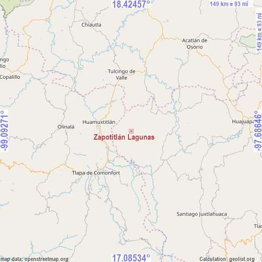
Zapotitlán Lagunas GPS coordinates[2]
17° 45' 22.356" North, 98° 23' 22.488" West
| Map corner | latitude | longitude |
|---|---|---|
| Upper-left | 18.42457°, | -99.09271° |
| Center: | 17.75621°, | -98.38958° |
| Lower-right: | 17.08534°, | -97.68646° |
| Map W x H: | 148.9×148.9 km | = 92.5×92.5mi |
| max Lat: | 32.7° ⇑80.9% North |
| Zapotitlán Lagunas: | 17.75621° |
| min Lat: | ⇓19.1% South 14.53588° |
| min Long | Zapotitlán Lag | max Long |
| -117.105° | -98.38958° | -86.73105° |
| W 58.8%⇐ | ⇒41.2% E |
Elevation
Elevation of Zapotitlán Lagunas is 1558 m = 5112 ft, and this is 304.3 m = 998 ft above average elevation for this country.
| Max E: |
3497 m = 11473 ft | 46.2% |
| Zapotitlán Lagunas | 1558 m 5112 ft | |
| Avg. | 1253.7 m = 4113 ft | |
Min E: |
-1 m = -3 ft | 53.8% |
See also: Mexico elevation on elevation.city.
Geographical zone
Zapotitlán Lagunas is located in North Torrid zone (between Equator and Tropic of Cancer). Distance of this Northern Tropic circle is 631.6 km =392.5 mi to North.| Distance of | km | miles | from Zapotitlán Lagunas |
|---|---|---|---|
| North Pole | 8032.8 | 4991.3 | to North |
| Arctic Circle | 5426.9 | 3372.1 | to North |
| Tropic Cancer | 631.6 | 392.5 | to North |
| Equator | 1974.3 | 1226.8 | to South |


Nearby cities:
15 places around Zapotitlán Lagunas: (largest is in red/bold)
• Ahuehuetitlán
12 km =7.5 mi,  142°
142°
• Alpoyeca
15.9 km =9.9 mi,  233°
233°
• Guadalupe del Recreo
7.7 km =4.8 mi,  51°
51°
• San José Buenavista
17.1 km =10.6 mi,  237°
237°
• San Juan Ihualtepec
10.8 km =6.7 mi,  99°
99°
• San Juan la Ciénega
15.6 km =9.7 mi, 47°
• San Mateo Nejápam
11.5 km =7.1 mi,  194°
194°
• San Pedro Aytec
15.9 km =9.9 mi,  245°
245°
• Santa Ana Rayón
15.9 km =9.9 mi,  42°
42°
• Tecoyame de Guadalupe
16.2 km =10.1 mi,  204°
204°
• Tepetlapa
10 km =6.2 mi,  181°
181°
• Tlachichilco
15.7 km =9.8 mi,  161°
161°
• Tlalquetzala
16.7 km =10.4 mi, 250°
• Tlaquiltepec
16.9 km =10.5 mi,  260°
260°
• Xixingo de los Reyes
15.5 km =9.6 mi,  353°
353°
Sources, notices
• [Note1] Compared only with cities in Mexico existing in our database
• [Src1] Map data: © OpenStreetMap contributors (CC-BY-SA)
• [Src2] Other city data from geonames.org with taken over terms of usage.
• [Src3] Geographical zone / Annual Mean Temperature by Robert A. Rohde @ Wikipedia
