Apango geodata
Apango (Guerrero) is a seat of a second-order administrative division; located in Mexico in America/Mexico_City (GMT-6) time zone. With population of 4,345 people, there are 2111 cities with bigger population in this country. Compared to other cities in Mexico, 81% of cities are located further ↑North; 54.6% of cities are located further →East and 58.2% of cities have higher elevation than Apango. Note1


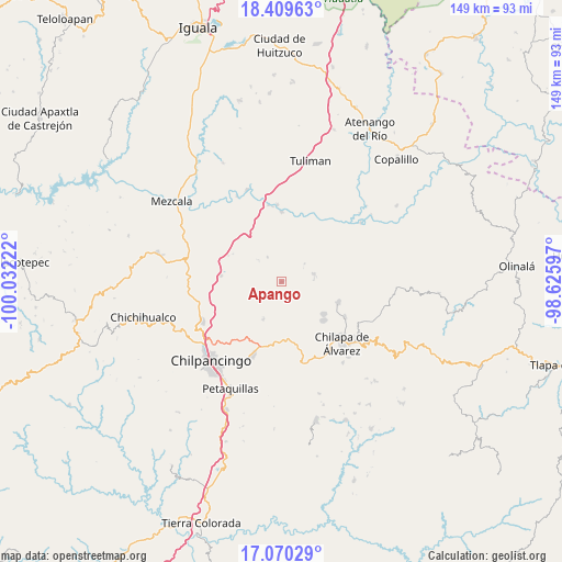
Apango GPS coordinates[2]
17° 44' 28.356" North, 99° 19' 44.724" West
| Map corner | latitude | longitude |
|---|---|---|
| Upper-left | 18.40963°, | -100.03222° |
| Center: | 17.74121°, | -99.32909° |
| Lower-right: | 17.07029°, | -98.62597° |
| Map W x H: | 148.9×148.9 km | = 92.5×92.5mi |
| max Lat: | 32.7° ⇑81% North |
| Apango: | 17.74121° |
| min Lat: | ⇓19% South 14.53588° |
| min Long | Apango | max Long |
| -117.105° | -99.32909° | -86.73105° |
| W 45.4%⇐ | ⇒54.6% E |
Elevation
Elevation of Apango is 1097 m = 3599 ft, and this is 156.7 m = 514 ft below average elevation for this country.
| Max E: |
3497 m = 11473 ft | 58.2% |
| Avg. | 1253.7 m = 4113 ft | |
| Apango | 1097 m = 3599 ft | |
Min E: |
-1 m = -3 ft | 41.8% |
See also: Mexico elevation on elevation.city.
Geographical zone
Apango is located in North Torrid zone (between Equator and Tropic of Cancer). Distance of this Northern Tropic circle is 633.3 km =393.5 mi to North.| Distance of | km | miles | from Apango |
|---|---|---|---|
| North Pole | 8034.4 | 4992.3 | to North |
| Arctic Circle | 5428.5 | 3373.1 | to North |
| Tropic Cancer | 633.3 | 393.5 | to North |
| Equator | 1972.6 | 1225.7 | to South |


Nearby cities:
15 places around Apango: (largest is in red/bold)
• Acatempa
11.6 km =7.2 mi,  199°
199°
• Almolonga
12 km =7.5 mi,  162°
162°
• Atliaca
11.1 km =6.9 mi,  205°
205°
• Axaxacualco
15.7 km =9.8 mi,  296°
296°
• Ayotzinapa
9.9 km =6.2 mi,  106°
106°
• Hueyitlalpan
8.1 km =5 mi,  154°
154°
• Huitziltepec
16 km =9.9 mi,  275°
275°
• La Esperanza
8.9 km =5.5 mi,  76°
76°
• Las Trancas
11.7 km =7.3 mi, 109°
• Mazatepec
14.6 km =9.1 mi,  125°
125°
• Pochahuizco
14.1 km =8.8 mi, 127°
• Rancho de las Lomas
8.8 km =5.5 mi,  91°
91°
• Tlanipatla
14.9 km =9.3 mi, 299°
• Topiltepec
15.1 km =9.4 mi, 131°
• Zotoltitlán
5 km =3.1 mi, 127°
Sources, notices
• [Note1] Compared only with cities in Mexico existing in our database
• [Src1] Map data: © OpenStreetMap contributors (CC-BY-SA)
• [Src2] Other city data from geonames.org with taken over terms of usage.
• [Src3] Geographical zone / Annual Mean Temperature by Robert A. Rohde @ Wikipedia
