Tenangulto geodata
Tenangulto (Puebla) is a populated place; located in Mexico in America/Mexico_City (GMT-6) time zone. With population of 613 people, there are 14065 cities with bigger population in this country. Compared to other cities in Mexico, 64% of cities are located further ↓South; 66.3% of cities are located further ←West and 67.3% of cities have higher elevation than Tenangulto. Note1


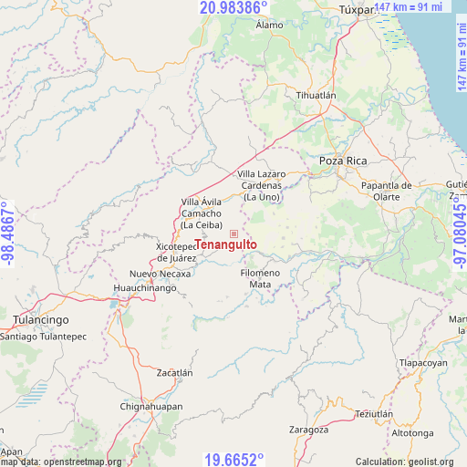
Tenangulto GPS coordinates[2]
20° 19' 33.384" North, 97° 47' 0.852" West
| Map corner | latitude | longitude |
|---|---|---|
| Upper-left | 20.98386°, | -98.4867° |
| Center: | 20.32594°, | -97.78357° |
| Lower-right: | 19.6652°, | -97.08045° |
| Map W x H: | 146.6×146.6 km | = 91.1×91.1mi |
| max Lat: | 32.7° ⇑36% North |
| Tenangulto: | 20.32594° |
| min Lat: | ⇓64% South 14.53588° |
| min Long | Tenangulto | max Long |
| -117.105° | -97.78357° | -86.73105° |
| W 66.3%⇐ | ⇒33.7% E |
Elevation
Elevation of Tenangulto is 565 m = 1854 ft, and this is 688.7 m = 2260 ft below average elevation for this country.
| Max E: |
3497 m = 11473 ft | 67.3% |
| Avg. | 1253.7 m = 4113 ft | |
| Tenangulto | 565 m = 1854 ft | |
Min E: |
-1 m = -3 ft | 32.7% |
See also: Mexico elevation on elevation.city.
Geographical zone
Tenangulto is located in North Torrid zone (between Equator and Tropic of Cancer). Distance of this Northern Tropic circle is 345.9 km =214.9 mi to North.| Distance of | km | miles | from Tenangulto |
|---|---|---|---|
| North Pole | 7747 | 4813.8 | to North |
| Arctic Circle | 5141.1 | 3194.5 | to North |
| Tropic Cancer | 345.9 | 214.9 | to North |
| Equator | 2260 | 1404.3 | to South |


Nearby cities:
15 places around Tenangulto: (largest is in red/bold)
• Apapantilla
10.9 km =6.8 mi,  322°
322°
• Cerro Verde
3.7 km =2.3 mi,  64°
64°
• Chicontla
10.3 km =6.4 mi,  208°
208°
• Cinco de Octubre
11.3 km =7 mi,  217°
217°
• Coahuitlán
9.2 km =5.7 mi,  142°
142°
• El Tepetate
11.3 km =7 mi,  358°
358°
• Gilberto Camacho
11.9 km =7.4 mi,  296°
296°
• La Palma
10 km =6.2 mi,  18°
18°
• La Unión
11.6 km =7.2 mi,  232°
232°
• Macedonio Alonso
11.2 km =7 mi,  121°
121°
• Patla
11.3 km =7 mi, 219°
• Progreso de Zaragoza
9.4 km =5.8 mi,  127°
127°
• San Pedro Tlaolantongo
10.7 km =6.6 mi,  190°
190°
• Santa Rita
5.5 km =3.4 mi, 320°
• Tlaxcalantongo
9.3 km =5.8 mi,  261°
261°
Sources, notices
• [Note1] Compared only with cities in Mexico existing in our database
• [Src1] Map data: © OpenStreetMap contributors (CC-BY-SA)
• [Src2] Other city data from geonames.org with taken over terms of usage.
• [Src3] Geographical zone / Annual Mean Temperature by Robert A. Rohde @ Wikipedia
