San Pedro Tlaolantongo geodata
San Pedro Tlaolantongo (Puebla) is a populated place; located in Mexico in America/Mexico_City (GMT-6) time zone. With population of 1,004 people, there are 8677 cities with bigger population in this country. Compared to other cities in Mexico, 62.1% of cities are located further ↓South; 66% of cities are located further ←West and 72.9% of cities have higher elevation than San Pedro Tlaolantongo. Note1
Current local time in San Pedro Tlaolantongo:
08:28 AM, WednesdayDifference from your time zone: hours


San Pedro Tlaolantongo GPS coordinates[2]
20° 13' 52.32" North, 97° 48' 7.668" West
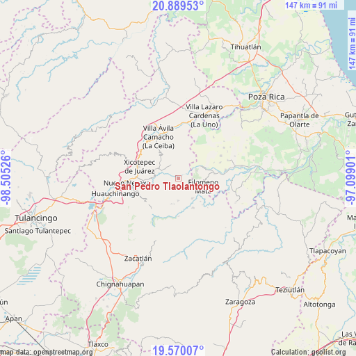
| Map corner | latitude | longitude |
|---|---|---|
| Upper-left | 20.88953°, | -98.50526° |
| Center: | 20.2312°, | -97.80213° |
| Lower-right: | 19.57007°, | -97.09901° |
| Map W x H: | 146.7×146.7 km | = 91.2×91.2mi |
| max Lat: | 32.7° ⇑37.9% North |
| San Pedro Tlaolantongo: | 20.2312° |
| min Lat: | ⇓62.1% South 14.53588° |
| min Long | San Pedro Tlaol | max Long |
| -117.105° | -97.80213° | -86.73105° |
| W 66%⇐ | ⇒34% E |
Elevation
Elevation of San Pedro Tlaolantongo is 296 m = 971 ft, and this is 957.7 m = 3142 ft below average elevation for this country.
| Max E: |
3497 m = 11473 ft | 72.9% |
| Avg. | 1253.7 m = 4113 ft | |
| San Pedro Tlaolantongo | 296 m = 971 ft | |
Min E: |
-1 m = -3 ft | 27.1% |
See also: Mexico elevation on elevation.city.
Geographical zone
San Pedro Tlaolantongo is located in North Torrid zone (between Equator and Tropic of Cancer). Distance of this Northern Tropic circle is 356.4 km =221.5 mi to North.| Distance of | km | miles | from San Pedro Tlaolantongo |
|---|---|---|---|
| North Pole | 7757.6 | 4820.3 | to North |
| Arctic Circle | 5151.7 | 3201.1 | to North |
| Tropic Cancer | 356.4 | 221.5 | to North |
| Equator | 2249.5 | 1397.8 | to South |


Nearby cities:
15 places around San Pedro Tlaolantongo: (largest is in red/bold)
• Ahuacatlaya
6.5 km =4 mi,  204°
204°
• Ahuaxintitla
10.1 km =6.3 mi,  284°
284°
• Atequexquitla
10 km =6.2 mi,  291°
291°
• Buenos Aires
10.3 km =6.4 mi,  147°
147°
• Chicontla
3.3 km =2.1 mi,  295°
295°
• Cinco de Octubre
5.2 km =3.2 mi, 287°
• Coahuitlán
8.3 km =5.2 mi,  66°
66°
• El Encinal
5 km =3.1 mi,  258°
258°
• La Unión
8 km =5 mi, 295°
• Ocomantla
9.7 km =6 mi, 278°
• Patla
5.6 km =3.5 mi, 289°
• Progreso de Zaragoza
10.6 km =6.6 mi,  62°
62°
• Tecpatlán
6.9 km =4.3 mi, 277°
• Tlamaya Grande
9.4 km =5.8 mi,  180°
180°
• Zihuateutla
9.2 km =5.7 mi, 283°
Sources, notices
• [Note1] Compared only with cities in Mexico existing in our database
• [Src1] Map data: © OpenStreetMap contributors (CC-BY-SA)
• [Src2] Other city data from geonames.org with taken over terms of usage.
• [Src3] Geographical zone / Annual Mean Temperature by Robert A. Rohde @ Wikipedia
