Cuahuihuitzotitla geodata
Cuahuihuitzotitla (Puebla) is a populated place; located in Mexico in America/Mexico_City (GMT-6) time zone. With population of 536 people, there are 15820 cities with bigger population in this country. Compared to other cities in Mexico, 61.3% of cities are located further ↓South; 62.3% of cities are located further ←West and 77.2% of cities have lower elevation than Cuahuihuitzotitla. Note1


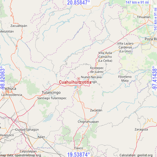
Cuahuihuitzotitla GPS coordinates[2]
20° 12' 0" North, 98° 7' 3" West
| Map corner | latitude | longitude |
|---|---|---|
| Upper-left | 20.85847°, | -98.82063° |
| Center: | 20.2°, | -98.1175° |
| Lower-right: | 19.53874°, | -97.41438° |
| Map W x H: | 146.7×146.7 km | = 91.2×91.2mi |
| max Lat: | 32.7° ⇑38.7% North |
| Cuahuihuitzotitla: | 20.2° |
| min Lat: | ⇓61.3% South 14.53588° |
| min Long | Cuahuihuitzotit | max Long |
| -117.105° | -98.1175° | -86.73105° |
| W 62.3%⇐ | ⇒37.7% E |
Elevation
Elevation of Cuahuihuitzotitla is 2072 m = 6798 ft, and this is 818.3 m = 2685 ft above average elevation for this country.
| Max E: |
3497 m = 11473 ft | 22.8% |
| Cuahuihuitzotitla | 2072 m 6798 ft | |
| Avg. | 1253.7 m = 4113 ft | |
Min E: |
-1 m = -3 ft | 77.2% |
See also: Mexico elevation on elevation.city.
Geographical zone
Cuahuihuitzotitla is located in North Torrid zone (between Equator and Tropic of Cancer). Distance of this Northern Tropic circle is 359.9 km =223.6 mi to North.| Distance of | km | miles | from Cuahuihuitzotitla |
|---|---|---|---|
| North Pole | 7761 | 4822.5 | to North |
| Arctic Circle | 5155.1 | 3203.2 | to North |
| Tropic Cancer | 359.9 | 223.6 | to North |
| Equator | 2246 | 1395.6 | to South |


Nearby cities:
15 places around Cuahuihuitzotitla: (largest is in red/bold)
• Atlantongo
7.2 km =4.5 mi,  359°
359°
• Chachahuantla
1.6 km =1 mi,  277°
277°
• Chimalapa
4.6 km =2.9 mi,  253°
253°
• El Tejocotal
6.7 km =4.2 mi,  188°
188°
• Huauchinango
7.2 km =4.5 mi,  114°
114°
• Huilacapixtla
4 km =2.5 mi,  69°
69°
• Icxotitla
5 km =3.1 mi,  20°
20°
• La Boveda
8.4 km =5.2 mi, 185°
• Los Reyes
7 km =4.3 mi,  224°
224°
• Naupan
3.6 km =2.2 mi,  14°
14°
• San Francisco Atotonilco
3.6 km =2.2 mi,  260°
260°
• San Miguel del Resgate
6.8 km =4.2 mi,  297°
297°
• Tlacomulco
5.2 km =3.2 mi,  183°
183°
• Tlaxpanaloya
2.9 km =1.8 mi,  354°
354°
• Xolotla
6.7 km =4.2 mi, 345°
Sources, notices
• [Note1] Compared only with cities in Mexico existing in our database
• [Src1] Map data: © OpenStreetMap contributors (CC-BY-SA)
• [Src2] Other city data from geonames.org with taken over terms of usage.
• [Src3] Geographical zone / Annual Mean Temperature by Robert A. Rohde @ Wikipedia
