Moyos geodata
Moyos (Chiapas) is a populated place; located in Mexico in America/Mexico_City (GMT-6) time zone. With population of 1,945 people, there are 4476 cities with bigger population in this country. Compared to other cities in Mexico, 84.6% of cities are located further ↑North; 90.9% of cities are located further ←West and 66.7% of cities have higher elevation than Moyos. Note1


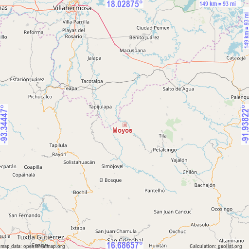
Moyos GPS coordinates[2]
17° 21' 32.004" North, 92° 38' 28.824" West
| Map corner | latitude | longitude |
|---|---|---|
| Upper-left | 18.02875°, | -93.34447° |
| Center: | 17.35889°, | -92.64134° |
| Lower-right: | 16.68657°, | -91.93822° |
| Map W x H: | 149.2×149.2 km | = 92.7×92.7mi |
| max Lat: | 32.7° ⇑84.6% North |
| Moyos: | 17.35889° |
| min Lat: | ⇓15.4% South 14.53588° |
| min Long | Moyos | max Long |
| -117.105° | -92.64134° | -86.73105° |
| W 90.9%⇐ | ⇒9.1% E |
Elevation
Elevation of Moyos is 603 m = 1978 ft, and this is 650.7 m = 2135 ft below average elevation for this country.
| Max E: |
3497 m = 11473 ft | 66.7% |
| Avg. | 1253.7 m = 4113 ft | |
| Moyos | 603 m = 1978 ft | |
Min E: |
-1 m = -3 ft | 33.3% |
See also: Mexico elevation on elevation.city.
Geographical zone
Moyos is located in North Torrid zone (between Equator and Tropic of Cancer). Distance of this Northern Tropic circle is 675.8 km =419.9 mi to North.| Distance of | km | miles | from Moyos |
|---|---|---|---|
| North Pole | 8076.9 | 5018.8 | to North |
| Arctic Circle | 5471 | 3399.5 | to North |
| Tropic Cancer | 675.8 | 419.9 | to North |
| Equator | 1930.1 | 1199.3 | to South |


Nearby cities:
15 places around Moyos: (largest is in red/bold)
• Campamento el Mirador
4 km =2.5 mi,  255°
255°
• Chulum Cárdenas
7.7 km =4.8 mi,  68°
68°
• Cristóbal Colón
1.6 km =1 mi,  250°
250°
• Cuitláhuac
9.5 km =5.9 mi,  268°
268°
• El Bebedero
4.4 km =2.7 mi,  350°
350°
• Huanal
10.5 km =6.5 mi,  235°
235°
• Jesús Carranza
6 km =3.7 mi, 346°
• Libertad
9.7 km =6 mi,  306°
306°
• Los Naranjos
10.7 km =6.6 mi,  167°
167°
• Majastic
7.8 km =4.8 mi, 169°
• Ostelucum
4.6 km =2.9 mi,  96°
96°
• Puxcatán
11.3 km =7 mi,  334°
334°
• Raya Zaragoza
7 km =4.3 mi,  318°
318°
• Unión Hidalgo (El Chorro)
4.2 km =2.6 mi,  86°
86°
• Unión Juárez
3.4 km =2.1 mi,  22°
22°
Sources, notices
• [Note1] Compared only with cities in Mexico existing in our database
• [Src1] Map data: © OpenStreetMap contributors (CC-BY-SA)
• [Src2] Other city data from geonames.org with taken over terms of usage.
• [Src3] Geographical zone / Annual Mean Temperature by Robert A. Rohde @ Wikipedia
