Raya Zaragoza geodata
Raya Zaragoza (Tabasco) is a populated place; located in Mexico in America/Mexico_City (GMT-6) time zone. With population of 1,471 people, there are 5878 cities with bigger population in this country. Compared to other cities in Mexico, 84.1% of cities are located further ↑North; 90.6% of cities are located further ←West and 81.1% of cities have higher elevation than Raya Zaragoza. Note1


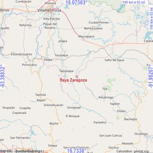
Raya Zaragoza GPS coordinates[2]
17° 24' 21.42" North, 92° 41' 6.684" West
| Map corner | latitude | longitude |
|---|---|---|
| Upper-left | 18.07563°, | -93.38832° |
| Center: | 17.40595°, | -92.68519° |
| Lower-right: | 16.7338°, | -91.98207° |
| Map W x H: | 149.2×149.2 km | = 92.7×92.7mi |
| max Lat: | 32.7° ⇑84.1% North |
| Raya Zaragoza: | 17.40595° |
| min Lat: | ⇓15.9% South 14.53588° |
| min Long | Raya Zaragoza | max Long |
| -117.105° | -92.68519° | -86.73105° |
| W 90.6%⇐ | ⇒9.4% E |
Elevation
Elevation of Raya Zaragoza is 80 m = 262 ft, and this is 1173.7 m = 3851 ft below average elevation for this country.
| Max E: |
3497 m = 11473 ft | 81.1% |
| Avg. | 1253.7 m = 4113 ft | |
| Raya Zaragoza | 80 m = 262 ft | |
Min E: |
-1 m = -3 ft | 18.9% |
See also: Mexico elevation on elevation.city.
Geographical zone
Raya Zaragoza is located in North Torrid zone (between Equator and Tropic of Cancer). Distance of this Northern Tropic circle is 670.6 km =416.7 mi to North.| Distance of | km | miles | from Raya Zaragoza |
|---|---|---|---|
| North Pole | 8071.7 | 5015.5 | to North |
| Arctic Circle | 5465.8 | 3396.3 | to North |
| Tropic Cancer | 670.6 | 416.7 | to North |
| Equator | 1935.4 | 1202.6 | to South |


Nearby cities:
15 places around Raya Zaragoza: (largest is in red/bold)
• Agua Blanca
11.1 km =6.9 mi,  37°
37°
• Campamento el Mirador
6.3 km =3.9 mi,  173°
173°
• Cristóbal Colón
6.6 km =4.1 mi,  151°
151°
• Cuauhtémoc Barreal
4.7 km =2.9 mi,  300°
300°
• Cuitláhuac
7.3 km =4.5 mi,  221°
221°
• El Bebedero
4.1 km =2.5 mi,  103°
103°
• Jesús Carranza
3.3 km =2.1 mi,  78°
78°
• Libertad
3.2 km =2 mi,  278°
278°
• Moyos
7 km =4.3 mi,  138°
138°
• Ostelucum
10.9 km =6.8 mi,  122°
122°
• Oxolotán
7.4 km =4.6 mi,  246°
246°
• Puxcatán
5 km =3.1 mi,  357°
357°
• Tapijulapa
11.8 km =7.3 mi, 302°
• Unión Hidalgo (El Chorro)
10.2 km =6.3 mi, 119°
• Unión Juárez
6.3 km =3.9 mi,  109°
109°
Sources, notices
• [Note1] Compared only with cities in Mexico existing in our database
• [Src1] Map data: © OpenStreetMap contributors (CC-BY-SA)
• [Src2] Other city data from geonames.org with taken over terms of usage.
• [Src3] Geographical zone / Annual Mean Temperature by Robert A. Rohde @ Wikipedia
