El Bebedero geodata
El Bebedero (Chiapas) is a populated place; located in Mexico in America/Mexico_City (GMT-6) time zone. With population of 668 people, there are 12987 cities with bigger population in this country. Compared to other cities in Mexico, 84.2% of cities are located further ↑North; 90.8% of cities are located further ←West and 71.4% of cities have higher elevation than El Bebedero. Note1


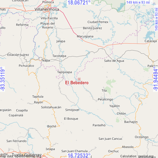
El Bebedero GPS coordinates[2]
17° 23' 51" North, 92° 38' 53.016" West
| Map corner | latitude | longitude |
|---|---|---|
| Upper-left | 18.06721°, | -93.35119° |
| Center: | 17.3975°, | -92.64806° |
| Lower-right: | 16.72532°, | -91.94494° |
| Map W x H: | 149.2×149.2 km | = 92.7×92.7mi |
| max Lat: | 32.7° ⇑84.2% North |
| El Bebedero: | 17.3975° |
| min Lat: | ⇓15.8% South 14.53588° |
| min Long | El Bebedero | max Long |
| -117.105° | -92.64806° | -86.73105° |
| W 90.8%⇐ | ⇒9.2% E |
Elevation
Elevation of El Bebedero is 350 m = 1148 ft, and this is 903.7 m = 2965 ft below average elevation for this country.
| Max E: |
3497 m = 11473 ft | 71.4% |
| Avg. | 1253.7 m = 4113 ft | |
| El Bebedero | 350 m = 1148 ft | |
Min E: |
-1 m = -3 ft | 28.6% |
See also: Mexico elevation on elevation.city.
Geographical zone
El Bebedero is located in North Torrid zone (between Equator and Tropic of Cancer). Distance of this Northern Tropic circle is 671.5 km =417.3 mi to North.| Distance of | km | miles | from El Bebedero |
|---|---|---|---|
| North Pole | 8072.6 | 5016.1 | to North |
| Arctic Circle | 5466.8 | 3396.9 | to North |
| Tropic Cancer | 671.5 | 417.3 | to North |
| Equator | 1934.4 | 1202 | to South |


Nearby cities:
15 places around El Bebedero: (largest is in red/bold)
• Agua Blanca
10.2 km =6.3 mi,  15°
15°
• Campamento el Mirador
6.2 km =3.9 mi,  211°
211°
• Chulum Cárdenas
8 km =5 mi,  100°
100°
• Cristóbal Colón
4.9 km =3 mi,  189°
189°
• Cuauhtémoc Barreal
8.6 km =5.3 mi,  292°
292°
• Cuitláhuac
9.9 km =6.2 mi,  242°
242°
• Jesús Carranza
1.7 km =1.1 mi,  335°
335°
• Libertad
7.2 km =4.5 mi,  281°
281°
• Moyos
4.4 km =2.7 mi,  170°
170°
• Ostelucum
7.1 km =4.4 mi,  132°
132°
• Oxolotán
10.9 km =6.8 mi,  259°
259°
• Puxcatán
7.2 km =4.5 mi,  325°
325°
• Raya Zaragoza
4.1 km =2.5 mi, 283°
• Unión Hidalgo (El Chorro)
6.4 km =4 mi, 129°
• Unión Juárez
2.3 km =1.4 mi,  120°
120°
Sources, notices
• [Note1] Compared only with cities in Mexico existing in our database
• [Src1] Map data: © OpenStreetMap contributors (CC-BY-SA)
• [Src2] Other city data from geonames.org with taken over terms of usage.
• [Src3] Geographical zone / Annual Mean Temperature by Robert A. Rohde @ Wikipedia
