Unión Hidalgo (El Chorro) geodata
Unión Hidalgo (El Chorro) (Chiapas) is a populated place; located in Mexico in America/Mexico_City (GMT-6) time zone. With population of 912 people, there are 9567 cities with bigger population in this country. Compared to other cities in Mexico, 84.6% of cities are located further ↑North; 91.1% of cities are located further ←West and 65.5% of cities have higher elevation than Unión Hidalgo (El Chorro). Note1
Current local time in Unión Hidalgo (El Chorro):
06:49 AM, WednesdayDifference from your time zone: hours


Unión Hidalgo (El Chorro) GPS coordinates[2]
17° 21' 41.004" North, 92° 36' 6.012" West
| Map corner | latitude | longitude |
|---|---|---|
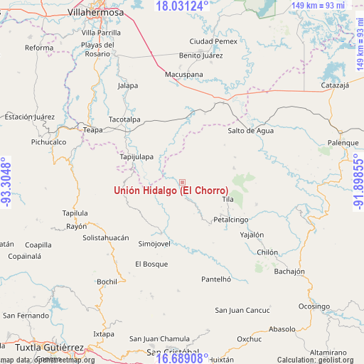
| Upper-left | 18.03124°, | -93.3048° |
| Center: | 17.36139°, | -92.60167° |
| Lower-right: | 16.68908°, | -91.89855° |
| Map W x H: | 149.2×149.2 km | = 92.7×92.7mi |
| max Lat: | 32.7° ⇑84.6% North |
| Unión Hidalgo (El Chorro): | 17.36139° |
| min Lat: | ⇓15.4% South 14.53588° |
| min Long | Unión Hidalgo | max Long |
| -117.105° | -92.60167° | -86.73105° |
| W 91.1%⇐ | ⇒8.9% E |
Elevation
Elevation of Unión Hidalgo (El Chorro) is 658 m = 2159 ft, and this is 595.7 m = 1954 ft below average elevation for this country.
| Max E: |
3497 m = 11473 ft | 65.5% |
| Avg. | 1253.7 m = 4113 ft | |
| Unión Hidalgo (El Chorro) | 658 m = 2159 ft | |
Min E: |
-1 m = -3 ft | 34.5% |
See also: Mexico elevation on elevation.city.
Geographical zone
Unión Hidalgo (El Chorro) is located in North Torrid zone (between Equator and Tropic of Cancer). Distance of this Northern Tropic circle is 675.5 km =419.7 mi to North.| Distance of | km | miles | from Unión Hidalgo (El Chorro) |
|---|---|---|---|
| North Pole | 8076.7 | 5018.6 | to North |
| Arctic Circle | 5470.8 | 3399.4 | to North |
| Tropic Cancer | 675.5 | 419.7 | to North |
| Equator | 1930.4 | 1199.5 | to South |


Nearby cities:
15 places around Unión Hidalgo (El Chorro): (largest is in red/bold)
• Campamento el Mirador
8.2 km =5.1 mi,  261°
261°
• Chulum Cárdenas
3.9 km =2.4 mi,  49°
49°
• Chulum Juárez
7.9 km =4.9 mi,  114°
114°
• Cristóbal Colón
5.8 km =3.6 mi, 261°
• El Bebedero
6.4 km =4 mi,  309°
309°
• Jesús Carranza
7.9 km =4.9 mi, 314°
• La Revolución
11.2 km =7 mi,  131°
131°
• Los Naranjos
10.9 km =6.8 mi,  190°
190°
• Majastic
8.5 km =5.3 mi,  199°
199°
• Moyos
4.2 km =2.6 mi,  266°
266°
• Ostelucum
0.9 km =0.6 mi,  158°
158°
• Raya Zaragoza
10.2 km =6.3 mi,  299°
299°
• Sabanilla
10 km =6.2 mi,  149°
149°
• Unión Juárez
4.1 km =2.5 mi, 313°
• Álvaro Obregón
11.1 km =6.9 mi,  31°
31°
Sources, notices
• [Note1] Compared only with cities in Mexico existing in our database
• [Src1] Map data: © OpenStreetMap contributors (CC-BY-SA)
• [Src2] Other city data from geonames.org with taken over terms of usage.
• [Src3] Geographical zone / Annual Mean Temperature by Robert A. Rohde @ Wikipedia
