Motoltepec geodata
Motoltepec (Hidalgo) is a populated place; located in Mexico in America/Mexico_City (GMT-6) time zone. With population of 516 people, there are 16314 cities with bigger population in this country. Compared to other cities in Mexico, 78.8% of cities are located further ↓South; 59% of cities are located further ←West and 78.3% of cities have higher elevation than Motoltepec. Note1


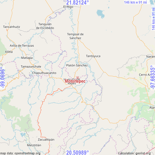
Motoltepec GPS coordinates[2]
21° 10' 1.272" North, 98° 21' 59.292" West
| Map corner | latitude | longitude |
|---|---|---|
| Upper-left | 21.82124°, | -99.0696° |
| Center: | 21.16702°, | -98.36647° |
| Lower-right: | 20.50989°, | -97.66335° |
| Map W x H: | 145.8×145.8 km | = 90.6×90.6mi |
| max Lat: | 32.7° ⇑21.2% North |
| Motoltepec: | 21.16702° |
| min Lat: | ⇓78.8% South 14.53588° |
| min Long | Motoltepec | max Long |
| -117.105° | -98.36647° | -86.73105° |
| W 59%⇐ | ⇒41% E |
Elevation
Elevation of Motoltepec is 124 m = 407 ft, and this is 1129.7 m = 3706 ft below average elevation for this country.
| Max E: |
3497 m = 11473 ft | 78.3% |
| Avg. | 1253.7 m = 4113 ft | |
| Motoltepec | 124 m = 407 ft | |
Min E: |
-1 m = -3 ft | 21.7% |
See also: Mexico elevation on elevation.city.
Geographical zone
Motoltepec is located in North Torrid zone (between Equator and Tropic of Cancer). Distance of this Northern Tropic circle is 252.4 km =156.8 mi to North.| Distance of | km | miles | from Motoltepec |
|---|---|---|---|
| North Pole | 7653.5 | 4755.7 | to North |
| Arctic Circle | 5047.6 | 3136.4 | to North |
| Tropic Cancer | 252.4 | 156.8 | to North |
| Equator | 2353.6 | 1462.5 | to South |


Nearby cities:
15 places around Motoltepec: (largest is in red/bold)
• Ahuatempa
7.8 km =4.8 mi,  192°
192°
• Chalahuiyapa
1.8 km =1.1 mi,  172°
172°
• Chalma
5.7 km =3.5 mi,  324°
324°
• Chililico
8 km =5 mi,  243°
243°
• Congreso Permanente Agrario
7.9 km =4.9 mi,  116°
116°
• Corral Blanco (Todos por Hidalgo)
2.7 km =1.7 mi, 236°
• El Pintor
4.9 km =3 mi,  259°
259°
• Huejutla de Reyes
6.3 km =3.9 mi, 241°
• Las Pilas
4.1 km =2.5 mi, 256°
• Los Otates
2.8 km =1.7 mi,  130°
130°
• Parque de Poblamiento Solidaridad
2.6 km =1.6 mi,  230°
230°
• Rancho Viejo
5.1 km =3.2 mi,  95°
95°
• Santa Catarina
7.5 km =4.7 mi, 191°
• Tancazahuela
7.3 km =4.5 mi,  284°
284°
• Zapotitla
9.1 km =5.7 mi, 244°
Sources, notices
• [Note1] Compared only with cities in Mexico existing in our database
• [Src1] Map data: © OpenStreetMap contributors (CC-BY-SA)
• [Src2] Other city data from geonames.org with taken over terms of usage.
• [Src3] Geographical zone / Annual Mean Temperature by Robert A. Rohde @ Wikipedia
