Mata de Lázaro geodata
Mata de Lázaro (Veracruz) is a populated place; located in Mexico in America/Mexico_City (GMT-6) time zone. With population of 510 people, there are 16480 cities with bigger population in this country. Compared to other cities in Mexico, 69.3% of cities are located further ↑North; 81.2% of cities are located further ←West and 84.7% of cities have higher elevation than Mata de Lázaro. Note1


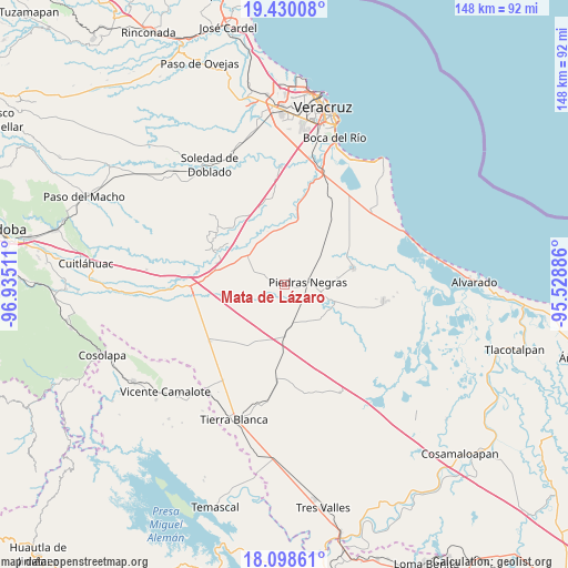
Mata de Lázaro GPS coordinates[2]
18° 45' 56.376" North, 96° 13' 55.128" West
| Map corner | latitude | longitude |
|---|---|---|
| Upper-left | 19.43008°, | -96.93511° |
| Center: | 18.76566°, | -96.23198° |
| Lower-right: | 18.09861°, | -95.52886° |
| Map W x H: | 148×148 km | = 92×92mi |
| max Lat: | 32.7° ⇑69.3% North |
| Mata de Lázaro: | 18.76566° |
| min Lat: | ⇓30.7% South 14.53588° |
| min Long | Mata de Lázaro | max Long |
| -117.105° | -96.23198° | -86.73105° |
| W 81.2%⇐ | ⇒18.8% E |
Elevation
Elevation of Mata de Lázaro is 46 m = 151 ft, and this is 1207.7 m = 3962 ft below average elevation for this country.
| Max E: |
3497 m = 11473 ft | 84.7% |
| Avg. | 1253.7 m = 4113 ft | |
| Mata de Lázaro | 46 m = 151 ft | |
Min E: |
-1 m = -3 ft | 15.3% |
See also: Mexico elevation on elevation.city.
Geographical zone
Mata de Lázaro is located in North Torrid zone (between Equator and Tropic of Cancer). Distance of this Northern Tropic circle is 519.4 km =322.7 mi to North.| Distance of | km | miles | from Mata de Lázaro |
|---|---|---|---|
| North Pole | 7920.5 | 4921.6 | to North |
| Arctic Circle | 5314.6 | 3302.3 | to North |
| Tropic Cancer | 519.4 | 322.7 | to North |
| Equator | 2086.5 | 1296.5 | to South |


Nearby cities:
15 places around Mata de Lázaro: (largest is in red/bold)
• Cotaxtla
19 km =11.8 mi,  294°
294°
• Cuyucuenda
4.7 km =2.9 mi, 292°
• Ejidal
15.4 km =9.6 mi,  2°
2°
• El Cocuite
16.4 km =10.2 mi,  108°
108°
• El Contento
15.5 km =9.6 mi,  166°
166°
• El Sauce (Cerro Grande)
18.3 km =11.4 mi, 108°
• El Zapote
11.4 km =7.1 mi,  88°
88°
• Joachín
14.1 km =8.8 mi,  180°
180°
• La Capilla
14.4 km =8.9 mi,  356°
356°
• Paso Carretas
13.4 km =8.3 mi,  132°
132°
• Paso Coyote
18.8 km =11.7 mi,  211°
211°
• Piedras Negras
6.4 km =4 mi, 85°
• Pozuelo
17.8 km =11.1 mi,  67°
67°
• Tlalixcoyan
18.5 km =11.5 mi,  77°
77°
• Tuzales
14.1 km =8.8 mi, 83°
Sources, notices
• [Note1] Compared only with cities in Mexico existing in our database
• [Src1] Map data: © OpenStreetMap contributors (CC-BY-SA)
• [Src2] Other city data from geonames.org with taken over terms of usage.
• [Src3] Geographical zone / Annual Mean Temperature by Robert A. Rohde @ Wikipedia
