Hueycantenango geodata
Hueycantenango (Guerrero) is a seat of a second-order administrative division; located in Mexico in America/Mexico_City (GMT-6) time zone. With population of 1,774 people, there are 4893 cities with bigger population in this country. Compared to other cities in Mexico, 83.6% of cities are located further ↑North; 50.2% of cities are located further →East and 56.7% of cities have lower elevation than Hueycantenango. Note1


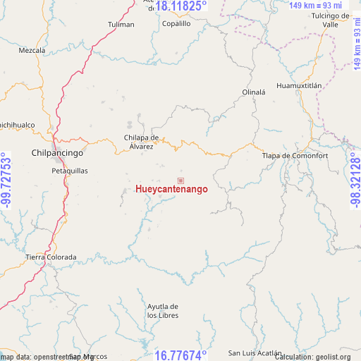
Hueycantenango GPS coordinates[2]
17° 26' 55.428" North, 99° 1' 27.84" West
| Map corner | latitude | longitude |
|---|---|---|
| Upper-left | 18.11825°, | -99.72753° |
| Center: | 17.44873°, | -99.0244° |
| Lower-right: | 16.77674°, | -98.32128° |
| Map W x H: | 149.2×149.2 km | = 92.7×92.7mi |
| max Lat: | 32.7° ⇑83.6% North |
| Hueycantenango: | 17.44873° |
| min Lat: | ⇓16.4% South 14.53588° |
| min Long | Hueycantenango | max Long |
| -117.105° | -99.0244° | -86.73105° |
| W 49.8%⇐ | ⇒50.2% E |
Elevation
Elevation of Hueycantenango is 1644 m = 5394 ft, and this is 390.3 m = 1281 ft above average elevation for this country.
| Max E: |
3497 m = 11473 ft | 43.3% |
| Hueycantenango | 1644 m 5394 ft | |
| Avg. | 1253.7 m = 4113 ft | |
Min E: |
-1 m = -3 ft | 56.7% |
See also: Mexico elevation on elevation.city.
Geographical zone
Hueycantenango is located in North Torrid zone (between Equator and Tropic of Cancer). Distance of this Northern Tropic circle is 665.8 km =413.7 mi to North.| Distance of | km | miles | from Hueycantenango |
|---|---|---|---|
| North Pole | 8066.9 | 5012.5 | to North |
| Arctic Circle | 5461.1 | 3393.4 | to North |
| Tropic Cancer | 665.8 | 413.7 | to North |
| Equator | 1940.1 | 1205.5 | to South |


Nearby cities:
15 places around Hueycantenango: (largest is in red/bold)
• Ahuixtla
9.2 km =5.7 mi,  352°
352°
• Alcozacán
9.7 km =6 mi,  309°
309°
• Apanguito
4.3 km =2.7 mi,  92°
92°
• Ayahualtempa
1.7 km =1.1 mi, 306°
• Cacahuatepec
8.3 km =5.2 mi,  134°
134°
• El Epazote
9.6 km =6 mi,  199°
199°
• Ixcatla
3.9 km =2.4 mi,  137°
137°
• Llano Grande
10 km =6.2 mi,  232°
232°
• Mazazontecomac
5.5 km =3.4 mi,  81°
81°
• Mexcalcingo
7.5 km =4.7 mi,  159°
159°
• Popocatzin
8 km =5 mi,  177°
177°
• Tlachimaltepec
4.2 km =2.6 mi,  16°
16°
• Tlalchichiltipán Nuevo
6.2 km =3.9 mi,  154°
154°
• Tomactilicán
3 km =1.9 mi,  68°
68°
• Zelocotitlán
8.7 km =5.4 mi,  268°
268°
Sources, notices
• [Note1] Compared only with cities in Mexico existing in our database
• [Src1] Map data: © OpenStreetMap contributors (CC-BY-SA)
• [Src2] Other city data from geonames.org with taken over terms of usage.
• [Src3] Geographical zone / Annual Mean Temperature by Robert A. Rohde @ Wikipedia
