Mazazontecomac geodata
Mazazontecomac (Guerrero) is a populated place; located in Mexico in America/Mexico_City (GMT-6) time zone. With population of 542 people, there are 15673 cities with bigger population in this country. Compared to other cities in Mexico, 83.6% of cities are located further ↑North; 50.6% of cities are located further ←West and 71.4% of cities have lower elevation than Mazazontecomac. Note1


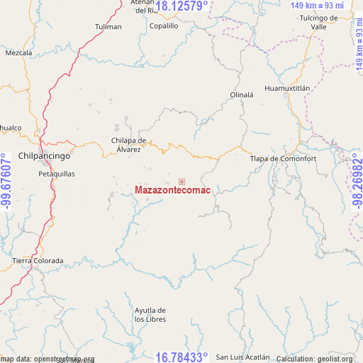
Mazazontecomac GPS coordinates[2]
17° 27' 22.644" North, 98° 58' 22.584" West
| Map corner | latitude | longitude |
|---|---|---|
| Upper-left | 18.12579°, | -99.67607° |
| Center: | 17.45629°, | -98.97294° |
| Lower-right: | 16.78433°, | -98.26982° |
| Map W x H: | 149.2×149.2 km | = 92.7×92.7mi |
| max Lat: | 32.7° ⇑83.6% North |
| Mazazontecomac: | 17.45629° |
| min Lat: | ⇓16.4% South 14.53588° |
| min Long | Mazazontecomac | max Long |
| -117.105° | -98.97294° | -86.73105° |
| W 50.6%⇐ | ⇒49.4% E |
Elevation
Elevation of Mazazontecomac is 1954 m = 6411 ft, and this is 700.3 m = 2298 ft above average elevation for this country.
| Max E: |
3497 m = 11473 ft | 28.6% |
| Mazazontecomac | 1954 m 6411 ft | |
| Avg. | 1253.7 m = 4113 ft | |
Min E: |
-1 m = -3 ft | 71.4% |
See also: Mexico elevation on elevation.city.
Geographical zone
Mazazontecomac is located in North Torrid zone (between Equator and Tropic of Cancer). Distance of this Northern Tropic circle is 665 km =413.2 mi to North.| Distance of | km | miles | from Mazazontecomac |
|---|---|---|---|
| North Pole | 8066.1 | 5012 | to North |
| Arctic Circle | 5460.2 | 3392.8 | to North |
| Tropic Cancer | 665 | 413.2 | to North |
| Equator | 1941 | 1206.1 | to South |


Nearby cities:
15 places around Mazazontecomac: (largest is in red/bold)
• Ahuixtla
10.6 km =6.6 mi,  320°
320°
• Apanguito
1.6 km =1 mi,  229°
229°
• Atlixtac
12.6 km =7.8 mi,  19°
19°
• Ayahualtempa
6.8 km =4.2 mi,  271°
271°
• Cacahuatepec
6.7 km =4.2 mi,  175°
175°
• Cacalotepec
12.1 km =7.5 mi,  130°
130°
• Hueycantenango
5.5 km =3.4 mi,  261°
261°
• Huixolotepec (Huitzolotepec)
12 km =7.5 mi,  144°
144°
• Ixcatla
4.7 km =2.9 mi,  216°
216°
• Mexcalcingo
8.4 km =5.2 mi,  199°
199°
• Popocatzin
10.2 km =6.3 mi,  209°
209°
• Tlachimaltepec
5.3 km =3.3 mi,  306°
306°
• Tlalchichiltipán Nuevo
7 km =4.3 mi, 203°
• Tomactilicán
2.7 km =1.7 mi,  275°
275°
• Xalpitzáhuac
10.7 km =6.6 mi,  108°
108°
Sources, notices
• [Note1] Compared only with cities in Mexico existing in our database
• [Src1] Map data: © OpenStreetMap contributors (CC-BY-SA)
• [Src2] Other city data from geonames.org with taken over terms of usage.
• [Src3] Geographical zone / Annual Mean Temperature by Robert A. Rohde @ Wikipedia
