El Epazote geodata
El Epazote (Guerrero) is a populated place; located in Mexico in America/Mexico_City (GMT-6) time zone. With population of 955 people, there are 9122 cities with bigger population in this country. Compared to other cities in Mexico, 84.5% of cities are located further ↑North; 50.5% of cities are located further →East and 62.7% of cities have higher elevation than El Epazote. Note1


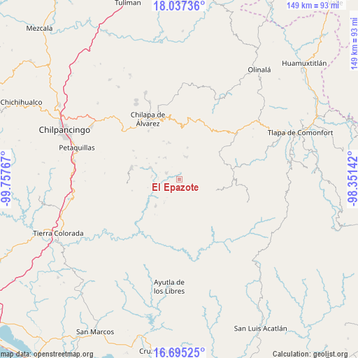
El Epazote GPS coordinates[2]
17° 22' 3.108" North, 99° 3' 16.344" West
| Map corner | latitude | longitude |
|---|---|---|
| Upper-left | 18.03736°, | -99.75767° |
| Center: | 17.36753°, | -99.05454° |
| Lower-right: | 16.69525°, | -98.35142° |
| Map W x H: | 149.2×149.2 km | = 92.7×92.7mi |
| max Lat: | 32.7° ⇑84.5% North |
| El Epazote: | 17.36753° |
| min Lat: | ⇓15.5% South 14.53588° |
| min Long | El Epazote | max Long |
| -117.105° | -99.05454° | -86.73105° |
| W 49.5%⇐ | ⇒50.5% E |
Elevation
Elevation of El Epazote is 839 m = 2753 ft, and this is 414.7 m = 1361 ft below average elevation for this country.
| Max E: |
3497 m = 11473 ft | 62.7% |
| Avg. | 1253.7 m = 4113 ft | |
| El Epazote | 839 m = 2753 ft | |
Min E: |
-1 m = -3 ft | 37.3% |
See also: Mexico elevation on elevation.city.
Geographical zone
El Epazote is located in North Torrid zone (between Equator and Tropic of Cancer). Distance of this Northern Tropic circle is 674.8 km =419.3 mi to North.| Distance of | km | miles | from El Epazote |
|---|---|---|---|
| North Pole | 8076 | 5018.2 | to North |
| Arctic Circle | 5470.1 | 3399 | to North |
| Tropic Cancer | 674.8 | 419.3 | to North |
| Equator | 1931.1 | 1199.9 | to South |


Nearby cities:
15 places around El Epazote: (largest is in red/bold)
• Apanguito
11.6 km =7.2 mi,  40°
40°
• Ayahualtempa
10.2 km =6.3 mi,  10°
10°
• Cacahuatepec
9.7 km =6 mi,  70°
70°
• Hueycantenango
9.6 km =6 mi,  19°
19°
• Ixcatla
8.5 km =5.3 mi, 43°
• Jocutla
9.3 km =5.8 mi,  252°
252°
• Llano Grande
5.7 km =3.5 mi,  301°
301°
• Mexcalcingo
6.2 km =3.9 mi, 71°
• Nanzintla
5.9 km =3.7 mi,  231°
231°
• Popocatzin
3.7 km =2.3 mi, 73°
• San Marcos
5.8 km =3.6 mi,  113°
113°
• Tlalchichiltipán Nuevo
6.8 km =4.2 mi,  59°
59°
• Tlanicuilulco
5.9 km =3.7 mi,  294°
294°
• Zelocotitlán
10.3 km =6.4 mi,  327°
327°
• Zoquitlán
11.5 km =7.1 mi,  104°
104°
Sources, notices
• [Note1] Compared only with cities in Mexico existing in our database
• [Src1] Map data: © OpenStreetMap contributors (CC-BY-SA)
• [Src2] Other city data from geonames.org with taken over terms of usage.
• [Src3] Geographical zone / Annual Mean Temperature by Robert A. Rohde @ Wikipedia
