Ahuixtla geodata
Ahuixtla (Guerrero) is a populated place; located in Mexico in America/Mexico_City (GMT-6) time zone. With population of 578 people, there are 14828 cities with bigger population in this country. Compared to other cities in Mexico, 82.8% of cities are located further ↑North; 50.3% of cities are located further →East and 71.3% of cities have lower elevation than Ahuixtla. Note1


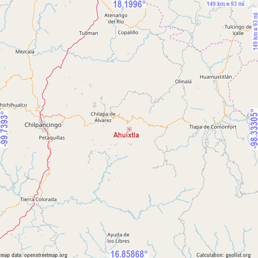
Ahuixtla GPS coordinates[2]
17° 31' 49.368" North, 99° 2' 10.212" West
| Map corner | latitude | longitude |
|---|---|---|
| Upper-left | 18.1996°, | -99.7393° |
| Center: | 17.53038°, | -99.03617° |
| Lower-right: | 16.85868°, | -98.33305° |
| Map W x H: | 149.1×149.1 km | = 92.6×92.6mi |
| max Lat: | 32.7° ⇑82.8% North |
| Ahuixtla: | 17.53038° |
| min Lat: | ⇓17.2% South 14.53588° |
| min Long | Ahuixtla | max Long |
| -117.105° | -99.03617° | -86.73105° |
| W 49.7%⇐ | ⇒50.3% E |
Elevation
Elevation of Ahuixtla is 1951 m = 6401 ft, and this is 697.3 m = 2288 ft above average elevation for this country.
| Max E: |
3497 m = 11473 ft | 28.7% |
| Ahuixtla | 1951 m 6401 ft | |
| Avg. | 1253.7 m = 4113 ft | |
Min E: |
-1 m = -3 ft | 71.3% |
See also: Mexico elevation on elevation.city.
Geographical zone
Ahuixtla is located in North Torrid zone (between Equator and Tropic of Cancer). Distance of this Northern Tropic circle is 656.7 km =408.1 mi to North.| Distance of | km | miles | from Ahuixtla |
|---|---|---|---|
| North Pole | 8057.9 | 5006.9 | to North |
| Arctic Circle | 5452 | 3387.7 | to North |
| Tropic Cancer | 656.7 | 408.1 | to North |
| Equator | 1949.2 | 1211.2 | to South |


Nearby cities:
15 places around Ahuixtla: (largest is in red/bold)
• Alcozacán
6.9 km =4.3 mi,  245°
245°
• Apanguito
10.8 km =6.7 mi,  149°
149°
• Atlixtac
11.4 km =7.1 mi,  71°
71°
• Atzacoaloya
10.9 km =6.8 mi,  279°
279°
• Ayahualtempa
8.1 km =5 mi,  180°
180°
• Hueycantenango
9.2 km =5.7 mi,  172°
172°
• Mazazontecomac
10.6 km =6.6 mi,  140°
140°
• Petatlán
7.5 km =4.7 mi,  41°
41°
• San Jerónimo Palantla
5.5 km =3.4 mi,  267°
267°
• Tepozonalco
4.7 km =2.9 mi,  7°
7°
• Tlachimaltepec
5.6 km =3.5 mi, 154°
• Tlalixtlahuacán
10.1 km =6.3 mi,  240°
240°
• Tomactilicán
8.9 km =5.5 mi, 153°
• Trigomila
11.5 km =7.1 mi,  300°
300°
• Zompeltepec
4.4 km =2.7 mi,  319°
319°
Sources, notices
• [Note1] Compared only with cities in Mexico existing in our database
• [Src1] Map data: © OpenStreetMap contributors (CC-BY-SA)
• [Src2] Other city data from geonames.org with taken over terms of usage.
• [Src3] Geographical zone / Annual Mean Temperature by Robert A. Rohde @ Wikipedia
