Tlalchichiltipán Nuevo geodata
Tlalchichiltipán Nuevo (Guerrero) is a populated place; located in Mexico in America/Mexico_City (GMT-6) time zone. With population of 813 people, there are 10742 cities with bigger population in this country. Compared to other cities in Mexico, 84.2% of cities are located further ↑North; 50.2% of cities are located further ←West and 58.8% of cities have higher elevation than Tlalchichiltipán Nuevo. Note1


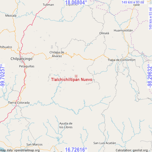
Tlalchichiltipán Nuevo GPS coordinates[2]
17° 23' 53.988" North, 98° 59' 57.984" West
| Map corner | latitude | longitude |
|---|---|---|
| Upper-left | 18.06804°, | -99.70257° |
| Center: | 17.39833°, | -98.99944° |
| Lower-right: | 16.72616°, | -98.29632° |
| Map W x H: | 149.2×149.2 km | = 92.7×92.7mi |
| max Lat: | 32.7° ⇑84.2% North |
| Tlalchichiltipán Nuevo: | 17.39833° |
| min Lat: | ⇓15.8% South 14.53588° |
| min Long | Tlalchichiltip� | max Long |
| -117.105° | -98.99944° | -86.73105° |
| W 50.2%⇐ | ⇒49.8% E |
Elevation
Elevation of Tlalchichiltipán Nuevo is 1064 m = 3491 ft, and this is 189.7 m = 622 ft below average elevation for this country.
| Max E: |
3497 m = 11473 ft | 58.8% |
| Avg. | 1253.7 m = 4113 ft | |
| Tlalchichiltipán Nuevo | 1064 m = 3491 ft | |
Min E: |
-1 m = -3 ft | 41.2% |
See also: Mexico elevation on elevation.city.
Geographical zone
Tlalchichiltipán Nuevo is located in North Torrid zone (between Equator and Tropic of Cancer). Distance of this Northern Tropic circle is 671.4 km =417.2 mi to North.| Distance of | km | miles | from Tlalchichiltipán Nuevo |
|---|---|---|---|
| North Pole | 8072.5 | 5016 | to North |
| Arctic Circle | 5466.7 | 3396.8 | to North |
| Tropic Cancer | 671.4 | 417.2 | to North |
| Equator | 1934.5 | 1202 | to South |


Nearby cities:
15 places around Tlalchichiltipán Nuevo: (largest is in red/bold)
• Apanguito
5.7 km =3.5 mi,  16°
16°
• Ayahualtempa
7.7 km =4.8 mi,  328°
328°
• Cacahuatepec
3.3 km =2.1 mi,  94°
94°
• Chichiltepec
9.6 km =6 mi,  135°
135°
• El Epazote
6.8 km =4.2 mi,  239°
239°
• Hueycantenango
6.2 km =3.9 mi, 334°
• Huixolotepec (Huitzolotepec)
10.3 km =6.4 mi,  108°
108°
• Ixcatla
2.7 km =1.7 mi,  0°
0°
• Mazazontecomac
7 km =4.3 mi, 23°
• Mexcalcingo
1.4 km =0.9 mi,  180°
180°
• Popocatzin
3.3 km =2.1 mi,  223°
223°
• San Marcos
5.7 km =3.5 mi, 184°
• Tlachimaltepec
9.7 km =6 mi,  351°
351°
• Tomactilicán
6.7 km =4.2 mi, 1°
• Zoquitlán
8.2 km =5.1 mi, 139°
Sources, notices
• [Note1] Compared only with cities in Mexico existing in our database
• [Src1] Map data: © OpenStreetMap contributors (CC-BY-SA)
• [Src2] Other city data from geonames.org with taken over terms of usage.
• [Src3] Geographical zone / Annual Mean Temperature by Robert A. Rohde @ Wikipedia
