Huahuaxtla geodata
Huahuaxtla (Puebla) is a populated place; located in Mexico in America/Mexico_City (GMT-6) time zone. With population of 2,471 people, there are 3581 cities with bigger population in this country. Compared to other cities in Mexico, 55.4% of cities are located further ↓South; 68% of cities are located further ←West and 53.9% of cities have lower elevation than Huahuaxtla. Note1


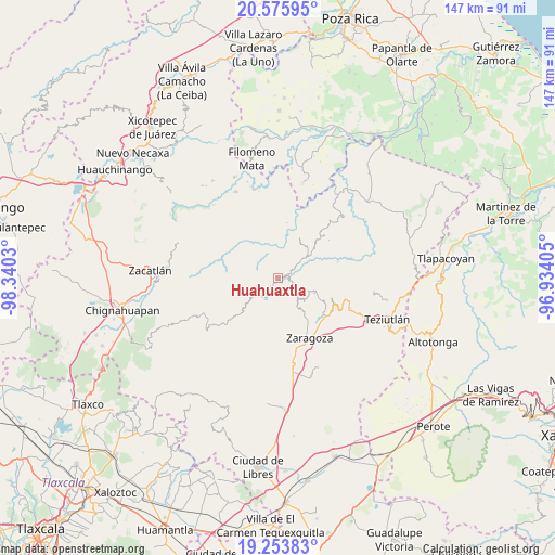
Huahuaxtla GPS coordinates[2]
19° 54' 58.572" North, 97° 38' 13.812" West
| Map corner | latitude | longitude |
|---|---|---|
| Upper-left | 20.57595°, | -98.3403° |
| Center: | 19.91627°, | -97.63717° |
| Lower-right: | 19.25383°, | -96.93405° |
| Map W x H: | 147×147 km | = 91.3×91.3mi |
| max Lat: | 32.7° ⇑44.6% North |
| Huahuaxtla: | 19.91627° |
| min Lat: | ⇓55.4% South 14.53588° |
| min Long | Huahuaxtla | max Long |
| -117.105° | -97.63717° | -86.73105° |
| W 68%⇐ | ⇒32% E |
Elevation
Elevation of Huahuaxtla is 1561 m = 5121 ft, and this is 307.3 m = 1008 ft above average elevation for this country.
| Max E: |
3497 m = 11473 ft | 46.1% |
| Huahuaxtla | 1561 m 5121 ft | |
| Avg. | 1253.7 m = 4113 ft | |
Min E: |
-1 m = -3 ft | 53.9% |
See also: Mexico elevation on elevation.city.
Geographical zone
Huahuaxtla is located in North Torrid zone (between Equator and Tropic of Cancer). Distance of this Northern Tropic circle is 391.4 km =243.2 mi to North.| Distance of | km | miles | from Huahuaxtla |
|---|---|---|---|
| North Pole | 7792.6 | 4842.1 | to North |
| Arctic Circle | 5186.7 | 3222.9 | to North |
| Tropic Cancer | 391.4 | 243.2 | to North |
| Equator | 2214.5 | 1376 | to South |


Nearby cities:
15 places around Huahuaxtla: (largest is in red/bold)
• Cohuatzalpan
7.5 km =4.7 mi,  108°
108°
• Comaltepec
7.5 km =4.7 mi,  148°
148°
• Huapalegcan
5.2 km =3.2 mi,  321°
321°
• Los Cristales (Talican)
6.6 km =4.1 mi,  137°
137°
• Nauzontla
6 km =3.7 mi,  36°
36°
• Pahuatla
4.3 km =2.7 mi,  308°
308°
• Primera Sección
7.7 km =4.8 mi, 311°
• San Francisco Zacapexpan
5.9 km =3.7 mi,  132°
132°
• San Rafael Axolota
4.1 km =2.5 mi,  49°
49°
• Santa Cruz Xaltetela
7.5 km =4.7 mi, 128°
• Xalacapan de Lucke
5.1 km =3.2 mi, 105°
• Xilita
5.4 km =3.4 mi,  84°
84°
• Zacapoaxtla
7 km =4.3 mi, 133°
• Zoatecpan
2.7 km =1.7 mi, 41°
• Zoyotla
6.1 km =3.8 mi,  282°
282°
Sources, notices
• [Note1] Compared only with cities in Mexico existing in our database
• [Src1] Map data: © OpenStreetMap contributors (CC-BY-SA)
• [Src2] Other city data from geonames.org with taken over terms of usage.
• [Src3] Geographical zone / Annual Mean Temperature by Robert A. Rohde @ Wikipedia
