Zoyotla geodata
Zoyotla (Puebla) is a populated place; located in Mexico in America/Mexico_City (GMT-6) time zone. With population of 1,066 people, there are 8182 cities with bigger population in this country. Compared to other cities in Mexico, 55.6% of cities are located further ↓South; 67.3% of cities are located further ←West and 56.2% of cities have higher elevation than Zoyotla. Note1


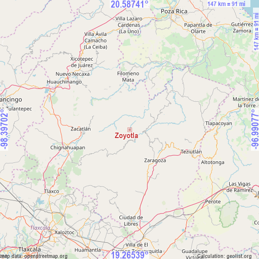
Zoyotla GPS coordinates[2]
19° 55' 40.008" North, 97° 41' 38.004" West
| Map corner | latitude | longitude |
|---|---|---|
| Upper-left | 20.58741°, | -98.39702° |
| Center: | 19.92778°, | -97.69389° |
| Lower-right: | 19.26539°, | -96.99077° |
| Map W x H: | 147×147 km | = 91.3×91.3mi |
| max Lat: | 32.7° ⇑44.4% North |
| Zoyotla: | 19.92778° |
| min Lat: | ⇓55.6% South 14.53588° |
| min Long | Zoyotla | max Long |
| -117.105° | -97.69389° | -86.73105° |
| W 67.3%⇐ | ⇒32.7% E |
Elevation
Elevation of Zoyotla is 1149 m = 3770 ft, and this is 104.7 m = 344 ft below average elevation for this country.
| Max E: |
3497 m = 11473 ft | 56.2% |
| Avg. | 1253.7 m = 4113 ft | |
| Zoyotla | 1149 m = 3770 ft | |
Min E: |
-1 m = -3 ft | 43.8% |
See also: Mexico elevation on elevation.city.
Geographical zone
Zoyotla is located in North Torrid zone (between Equator and Tropic of Cancer). Distance of this Northern Tropic circle is 390.2 km =242.5 mi to North.| Distance of | km | miles | from Zoyotla |
|---|---|---|---|
| North Pole | 7791.3 | 4841.3 | to North |
| Arctic Circle | 5185.4 | 3222.1 | to North |
| Tropic Cancer | 390.2 | 242.5 | to North |
| Equator | 2215.8 | 1376.8 | to South |


Nearby cities:
15 places around Zoyotla: (largest is in red/bold)
• Cuarta Sección
5.1 km =3.2 mi,  1°
1°
• Huahuaxtla
6.1 km =3.8 mi,  102°
102°
• Huapalegcan
3.9 km =2.4 mi,  43°
43°
• Huitzilan
4.4 km =2.7 mi,  359°
359°
• Nanacatlán
8.6 km =5.3 mi,  12°
12°
• Pahuatla
2.9 km =1.8 mi,  61°
61°
• Primera Sección
3.8 km =2.4 mi, 2°
• San Antonio Taltzintán
4.5 km =2.8 mi,  241°
241°
• San Miguel del Progreso
7.5 km =4.7 mi,  22°
22°
• San Rafael Axolota
9.2 km =5.7 mi,  81°
81°
• Tenepanigia (Santa Elena)
9.2 km =5.7 mi,  297°
297°
• Tuxtla
9 km =5.6 mi,  26°
26°
• Zapotitlán
8.5 km =5.3 mi,  345°
345°
• Zoatecpan
7.7 km =4.8 mi, 84°
• Zongozotla
6.7 km =4.2 mi,  328°
328°
Sources, notices
• [Note1] Compared only with cities in Mexico existing in our database
• [Src1] Map data: © OpenStreetMap contributors (CC-BY-SA)
• [Src2] Other city data from geonames.org with taken over terms of usage.
• [Src3] Geographical zone / Annual Mean Temperature by Robert A. Rohde @ Wikipedia
