Primera Sección geodata
Primera Sección (Puebla) is a populated place; located in Mexico in America/Mexico_City (GMT-6) time zone. With population of 583 people, there are 14713 cities with bigger population in this country. Compared to other cities in Mexico, 56.2% of cities are located further ↓South; 67.3% of cities are located further ←West and 60.8% of cities have higher elevation than Primera Sección. Note1


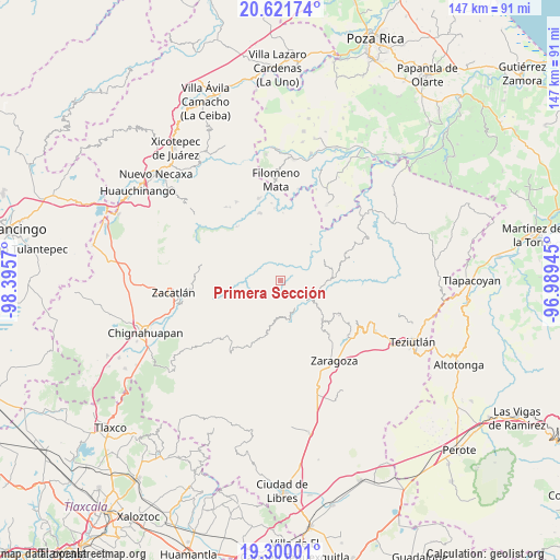
Primera Sección GPS coordinates[2]
19° 57' 44.136" North, 97° 41' 33.252" West
| Map corner | latitude | longitude |
|---|---|---|
| Upper-left | 20.62174°, | -98.3957° |
| Center: | 19.96226°, | -97.69257° |
| Lower-right: | 19.30001°, | -96.98945° |
| Map W x H: | 147×147 km | = 91.3×91.3mi |
| max Lat: | 32.7° ⇑43.8% North |
| Primera Sección: | 19.96226° |
| min Lat: | ⇓56.2% South 14.53588° |
| min Long | Primera Secció | max Long |
| -117.105° | -97.69257° | -86.73105° |
| W 67.3%⇐ | ⇒32.7% E |
Elevation
Elevation of Primera Sección is 949 m = 3114 ft, and this is 304.7 m = 1000 ft below average elevation for this country.
| Max E: |
3497 m = 11473 ft | 60.8% |
| Avg. | 1253.7 m = 4113 ft | |
| Primera Sección | 949 m = 3114 ft | |
Min E: |
-1 m = -3 ft | 39.2% |
See also: Mexico elevation on elevation.city.
Geographical zone
Primera Sección is located in North Torrid zone (between Equator and Tropic of Cancer). Distance of this Northern Tropic circle is 386.3 km =240 mi to North.| Distance of | km | miles | from Primera Sección |
|---|---|---|---|
| North Pole | 7787.5 | 4838.9 | to North |
| Arctic Circle | 5181.6 | 3219.7 | to North |
| Tropic Cancer | 386.3 | 240 | to North |
| Equator | 2219.6 | 1379.2 | to South |


Nearby cities:
15 places around Primera Sección: (largest is in red/bold)
• Cuarta Sección
1.3 km =0.8 mi,  1°
1°
• Huahuaxtla
7.7 km =4.8 mi,  131°
131°
• Huapalegcan
2.7 km =1.7 mi,  112°
112°
• Hueytlalpan
7.2 km =4.5 mi,  356°
356°
• Huitzilan
0.6 km =0.4 mi,  341°
341°
• Ignacio Allende (Concepción)
8.1 km =5 mi,  48°
48°
• Nanacatlán
4.9 km =3 mi,  20°
20°
• Pahuatla
3.4 km =2.1 mi,  135°
135°
• San Antonio Taltzintán
7.2 km =4.5 mi,  214°
214°
• San Martín
7.3 km =4.5 mi, 46°
• San Miguel del Progreso
4.1 km =2.5 mi,  41°
41°
• Tuxtla
5.8 km =3.6 mi, 42°
• Zapotitlán
5 km =3.1 mi,  333°
333°
• Zongozotla
4.1 km =2.5 mi,  297°
297°
• Zoyotla
3.8 km =2.4 mi,  182°
182°
Sources, notices
• [Note1] Compared only with cities in Mexico existing in our database
• [Src1] Map data: © OpenStreetMap contributors (CC-BY-SA)
• [Src2] Other city data from geonames.org with taken over terms of usage.
• [Src3] Geographical zone / Annual Mean Temperature by Robert A. Rohde @ Wikipedia
