Hidalgo geodata
Hidalgo (Tamaulipas) is a seat of a second-order administrative division; located in Mexico in America/Monterrey (GMT-6) time zone. With population of 4,558 people, there are 2017 cities with bigger population in this country. Compared to other cities in Mexico, 90.5% of cities are located further ↓South; 56.1% of cities are located further →East and 71.9% of cities have higher elevation than Hidalgo. Note1


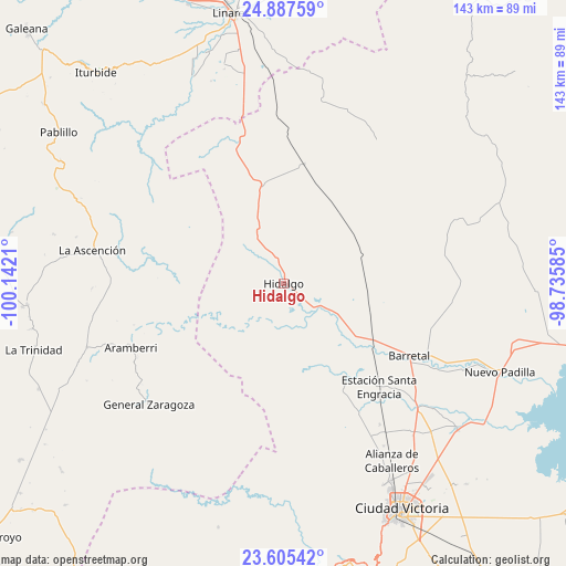
Hidalgo GPS coordinates[2]
24° 14' 53.232" North, 99° 26' 20.292" West
| Map corner | latitude | longitude |
|---|---|---|
| Upper-left | 24.88759°, | -100.1421° |
| Center: | 24.24812°, | -99.43897° |
| Lower-right: | 23.60542°, | -98.73585° |
| Map W x H: | 142.6×142.6 km | = 88.6×88.6mi |
| max Lat: | 32.7° ⇑9.5% North |
| Hidalgo: | 24.24812° |
| min Lat: | ⇓90.5% South 14.53588° |
| min Long | Hidalgo | max Long |
| -117.105° | -99.43897° | -86.73105° |
| W 43.9%⇐ | ⇒56.1% E |
Elevation
Elevation of Hidalgo is 331 m = 1086 ft, and this is 922.7 m = 3027 ft below average elevation for this country.
| Max E: |
3497 m = 11473 ft | 71.9% |
| Avg. | 1253.7 m = 4113 ft | |
| Hidalgo | 331 m = 1086 ft | |
Min E: |
-1 m = -3 ft | 28.1% |
See also: Mexico elevation on elevation.city.
Geographical zone
Hidalgo is located in North temperate zone (between Tropic of Cancer and the Arctic Circle). Distance of this Northern Tropic circle is 90.2 km =56 mi to South.| Distance of | km | miles | from Hidalgo |
|---|---|---|---|
| North Pole | 7310.9 | 4542.8 | to North |
| Arctic Circle | 4705 | 2923.6 | to North |
| Tropic Cancer | 90.2 | 56 | to South |
| Equator | 2696.1 | 1675.3 | to South |


Nearby cities:
15 places around Hidalgo: (largest is in red/bold)
• Aramberri
41.8 km =26 mi,  246°
246°
• Balconcitos (Balcones)
35.7 km =22.2 mi,  137°
137°
• Barretal
36.7 km =22.8 mi,  119°
119°
• Cruz y Cruz
30.5 km =19 mi, 123°
• El Barranco Azul
36.9 km =22.9 mi,  62°
62°
• El Saucillo
40.7 km =25.3 mi,  45°
45°
• Estación Santa Engracia
35.3 km =21.9 mi, 137°
• Garza Valdez
30.5 km =19 mi,  9°
9°
• Guadalupe Victoria
35.7 km =22.2 mi, 122°
• Guillermo Zúñiga
35.4 km =22 mi, 136°
• La Soledad
41 km =25.5 mi, 117°
• Oyama
22.4 km =13.9 mi,  126°
126°
• Plan de Ayala
39.1 km =24.3 mi, 123°
• Villa Mainero
39 km =24.2 mi,  332°
332°
• Villagrán
25.5 km =15.8 mi,  348°
348°
Sources, notices
• [Note1] Compared only with cities in Mexico existing in our database
• [Src1] Map data: © OpenStreetMap contributors (CC-BY-SA)
• [Src2] Other city data from geonames.org with taken over terms of usage.
• [Src3] Geographical zone / Annual Mean Temperature by Robert A. Rohde @ Wikipedia
