Villa Mainero geodata
Villa Mainero (Tamaulipas) is a seat of a second-order administrative division; located in Mexico in America/Monterrey (GMT-6) time zone. With population of 386 people, there are 16848 cities with bigger population in this country. Compared to other cities in Mexico, 91% of cities are located further ↓South; 58.9% of cities are located further →East and 68.8% of cities have higher elevation than Villa Mainero. Note1


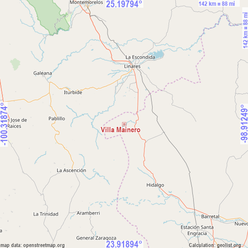
Villa Mainero GPS coordinates[2]
24° 33' 36.252" North, 99° 36' 56.196" West
| Map corner | latitude | longitude |
|---|---|---|
| Upper-left | 25.19794°, | -100.31874° |
| Center: | 24.56007°, | -99.61561° |
| Lower-right: | 23.91894°, | -98.91249° |
| Map W x H: | 142.2×142.2 km | = 88.4×88.4mi |
| max Lat: | 32.7° ⇑9% North |
| Villa Mainero: | 24.56007° |
| min Lat: | ⇓91% South 14.53588° |
| min Long | Villa Mainero | max Long |
| -117.105° | -99.61561° | -86.73105° |
| W 41.1%⇐ | ⇒58.9% E |
Elevation
Elevation of Villa Mainero is 482 m = 1581 ft, and this is 771.7 m = 2532 ft below average elevation for this country.
| Max E: |
3497 m = 11473 ft | 68.8% |
| Avg. | 1253.7 m = 4113 ft | |
| Villa Mainero | 482 m = 1581 ft | |
Min E: |
-1 m = -3 ft | 31.2% |
See also: Mexico elevation on elevation.city.
Geographical zone
Villa Mainero is located in North temperate zone (between Tropic of Cancer and the Arctic Circle). Distance of this Northern Tropic circle is 124.9 km =77.6 mi to South.| Distance of | km | miles | from Villa Mainero |
|---|---|---|---|
| North Pole | 7276.2 | 4521.2 | to North |
| Arctic Circle | 4670.4 | 2902.1 | to North |
| Tropic Cancer | 124.9 | 77.6 | to South |
| Equator | 2730.8 | 1696.8 | to South |


Nearby cities:
15 places around Villa Mainero: (largest is in red/bold)
• El Barranco Azul
53.7 km =33.4 mi,  109°
109°
• El Saucillo
47.1 km =29.3 mi,  97°
97°
• Galeana
55 km =34.2 mi,  302°
302°
• Garza Valdez
23.6 km =14.7 mi, 101°
• General Lucio Blanco
28.9 km =18 mi,  48°
48°
• Guadalupe
39.9 km =24.8 mi,  21°
21°
• Hidalgo
39 km =24.2 mi,  152°
152°
• Hualahuises
36.4 km =22.6 mi,  350°
350°
• Iturbide
34.5 km =21.4 mi, 302°
• La Ascensión
40 km =24.9 mi,  229°
229°
• La Escondida
39.9 km =24.8 mi,  14°
14°
• Linares
33.5 km =20.8 mi, 8°
• Pablillo
38.6 km =24 mi,  275°
275°
• Río Verde
38.6 km =24 mi, 10°
• Villagrán
15.9 km =9.9 mi,  127°
127°
Sources, notices
• [Note1] Compared only with cities in Mexico existing in our database
• [Src1] Map data: © OpenStreetMap contributors (CC-BY-SA)
• [Src2] Other city data from geonames.org with taken over terms of usage.
• [Src3] Geographical zone / Annual Mean Temperature by Robert A. Rohde @ Wikipedia
