Coyolapa geodata
Coyolapa (Puebla) is a populated place; located in Mexico in America/Mexico_City (GMT-6) time zone. With population of 572 people, there are 14957 cities with bigger population in this country. Compared to other cities in Mexico, 73.6% of cities are located further ↑North; 76.2% of cities are located further ←West and 68.3% of cities have higher elevation than Coyolapa. Note1


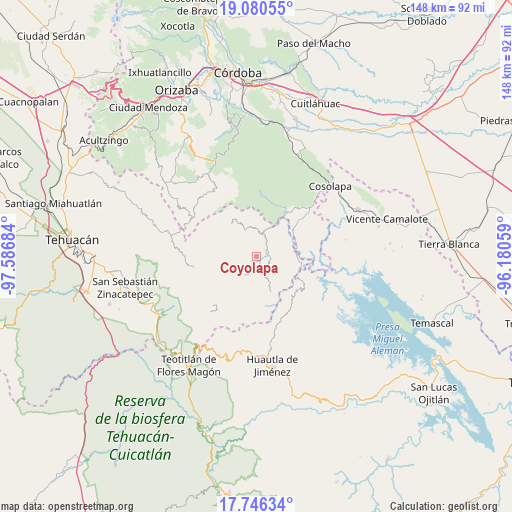
Coyolapa GPS coordinates[2]
18° 24' 53.064" North, 96° 53' 1.356" West
| Map corner | latitude | longitude |
|---|---|---|
| Upper-left | 19.08055°, | -97.58684° |
| Center: | 18.41474°, | -96.88371° |
| Lower-right: | 17.74634°, | -96.18059° |
| Map W x H: | 148.4×148.4 km | = 92.2×92.2mi |
| max Lat: | 32.7° ⇑73.6% North |
| Coyolapa: | 18.41474° |
| min Lat: | ⇓26.4% South 14.53588° |
| min Long | Coyolapa | max Long |
| -117.105° | -96.88371° | -86.73105° |
| W 76.2%⇐ | ⇒23.8% E |
Elevation
Elevation of Coyolapa is 512 m = 1680 ft, and this is 741.7 m = 2433 ft below average elevation for this country.
| Max E: |
3497 m = 11473 ft | 68.3% |
| Avg. | 1253.7 m = 4113 ft | |
| Coyolapa | 512 m = 1680 ft | |
Min E: |
-1 m = -3 ft | 31.7% |
See also: Mexico elevation on elevation.city.
Geographical zone
Coyolapa is located in North Torrid zone (between Equator and Tropic of Cancer). Distance of this Northern Tropic circle is 558.4 km =347 mi to North.| Distance of | km | miles | from Coyolapa |
|---|---|---|---|
| North Pole | 7959.5 | 4945.8 | to North |
| Arctic Circle | 5353.6 | 3326.6 | to North |
| Tropic Cancer | 558.4 | 347 | to North |
| Equator | 2047.5 | 1272.3 | to South |


Nearby cities:
15 places around Coyolapa: (largest is in red/bold)
• Achichinalco
13.8 km =8.6 mi,  305°
305°
• Buena Vista de Cuauhtémoc
12.2 km =7.6 mi,  155°
155°
• Caxapa
11.7 km =7.3 mi,  81°
81°
• Chiapa
8.7 km =5.4 mi, 311°
• El Suspiro
12.5 km =7.8 mi,  62°
62°
• Eloxochitlán
12 km =7.5 mi,  322°
322°
• Huitzmaloc
7.6 km =4.7 mi, 307°
• Limonestitla
11.7 km =7.3 mi,  30°
30°
• Loma Bonita
11.1 km =6.9 mi,  8°
8°
• San Martín Mazateopan
8.3 km =5.2 mi, 59°
• Tentziantla (San Marcos)
9 km =5.6 mi,  47°
47°
• Tepepan
13.2 km =8.2 mi,  349°
349°
• Tepetlampa
13.1 km =8.1 mi, 26°
• Tlacotepec
3.7 km =2.3 mi,  109°
109°
• Xonotipan de Juárez
8.8 km =5.5 mi, 350°
Sources, notices
• [Note1] Compared only with cities in Mexico existing in our database
• [Src1] Map data: © OpenStreetMap contributors (CC-BY-SA)
• [Src2] Other city data from geonames.org with taken over terms of usage.
• [Src3] Geographical zone / Annual Mean Temperature by Robert A. Rohde @ Wikipedia
