El Otate geodata
El Otate (Veracruz) is a populated place; located in Mexico in America/Mexico_City (GMT-6) time zone. With population of 676 people, there are 12846 cities with bigger population in this country. Compared to other cities in Mexico, 68.7% of cities are located further ↑North; 76.2% of cities are located further ←West and 65.9% of cities have higher elevation than El Otate. Note1


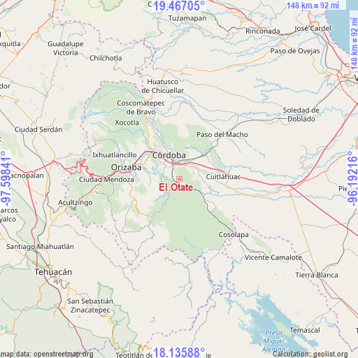
El Otate GPS coordinates[2]
18° 48' 10.008" North, 96° 53' 43.008" West
| Map corner | latitude | longitude |
|---|---|---|
| Upper-left | 19.46705°, | -97.59841° |
| Center: | 18.80278°, | -96.89528° |
| Lower-right: | 18.13588°, | -96.19216° |
| Map W x H: | 148×148 km | = 92×92mi |
| max Lat: | 32.7° ⇑68.7% North |
| El Otate: | 18.80278° |
| min Lat: | ⇓31.3% South 14.53588° |
| min Long | El Otate | max Long |
| -117.105° | -96.89528° | -86.73105° |
| W 76.2%⇐ | ⇒23.8% E |
Elevation
Elevation of El Otate is 639 m = 2096 ft, and this is 614.7 m = 2017 ft below average elevation for this country.
| Max E: |
3497 m = 11473 ft | 65.9% |
| Avg. | 1253.7 m = 4113 ft | |
| El Otate | 639 m = 2096 ft | |
Min E: |
-1 m = -3 ft | 34.1% |
See also: Mexico elevation on elevation.city.
Geographical zone
El Otate is located in North Torrid zone (between Equator and Tropic of Cancer). Distance of this Northern Tropic circle is 515.2 km =320.1 mi to North.| Distance of | km | miles | from El Otate |
|---|---|---|---|
| North Pole | 7916.4 | 4919 | to North |
| Arctic Circle | 5310.5 | 3299.8 | to North |
| Tropic Cancer | 515.2 | 320.1 | to North |
| Equator | 2090.7 | 1299.1 | to South |


Nearby cities:
15 places around El Otate: (largest is in red/bold)
• Amatlán de los Reyes
5.3 km =3.3 mi,  335°
335°
• Barrio Guadalupe
2.9 km =1.8 mi,  126°
126°
• Cacahuatal
6.4 km =4 mi,  60°
60°
• Centro de Readaptación Social
6.1 km =3.8 mi,  310°
310°
• Coetzala
3 km =1.9 mi,  229°
229°
• Coetzapotitla
6.2 km =3.9 mi,  218°
218°
• Cotlaixco
6.9 km =4.3 mi,  235°
235°
• Cuichapa
4.5 km =2.8 mi,  141°
141°
• Guadalupe
3.4 km =2.1 mi,  294°
294°
• Manuel León
6.2 km =3.9 mi,  24°
24°
• Peñuela
6.8 km =4.2 mi,  1°
1°
• Rincón de Buena Vista
6 km =3.7 mi,  151°
151°
• Tenejápam de Mata
3.7 km =2.3 mi,  156°
156°
• Trapiche Viejo
6.9 km =4.3 mi, 310°
• Villa Libertad
6.6 km =4.1 mi,  281°
281°
Sources, notices
• [Note1] Compared only with cities in Mexico existing in our database
• [Src1] Map data: © OpenStreetMap contributors (CC-BY-SA)
• [Src2] Other city data from geonames.org with taken over terms of usage.
• [Src3] Geographical zone / Annual Mean Temperature by Robert A. Rohde @ Wikipedia
