Chalingo geodata
Chalingo (Hidalgo) is a populated place; located in Mexico in America/Mexico_City (GMT-6) time zone. With population of 659 people, there are 13168 cities with bigger population in this country. Compared to other cities in Mexico, 77.9% of cities are located further ↓South; 61% of cities are located further ←West and 74.5% of cities have higher elevation than Chalingo. Note1


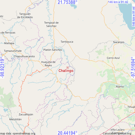
Chalingo GPS coordinates[2]
21° 5' 57.696" North, 98° 13' 12.216" West
| Map corner | latitude | longitude |
|---|---|---|
| Upper-left | 21.75388°, | -98.92319° |
| Center: | 21.09936°, | -98.22006° |
| Lower-right: | 20.44194°, | -97.51694° |
| Map W x H: | 145.9×145.9 km | = 90.7×90.7mi |
| max Lat: | 32.7° ⇑22.1% North |
| Chalingo: | 21.09936° |
| min Lat: | ⇓77.9% South 14.53588° |
| min Long | Chalingo | max Long |
| -117.105° | -98.22006° | -86.73105° |
| W 61%⇐ | ⇒39% E |
Elevation
Elevation of Chalingo is 235 m = 771 ft, and this is 1018.7 m = 3342 ft below average elevation for this country.
| Max E: |
3497 m = 11473 ft | 74.5% |
| Avg. | 1253.7 m = 4113 ft | |
| Chalingo | 235 m = 771 ft | |
Min E: |
-1 m = -3 ft | 25.5% |
See also: Mexico elevation on elevation.city.
Geographical zone
Chalingo is located in North Torrid zone (between Equator and Tropic of Cancer). Distance of this Northern Tropic circle is 259.9 km =161.5 mi to North.| Distance of | km | miles | from Chalingo |
|---|---|---|---|
| North Pole | 7661 | 4760.3 | to North |
| Arctic Circle | 5055.1 | 3141.1 | to North |
| Tropic Cancer | 259.9 | 161.5 | to North |
| Equator | 2346 | 1457.7 | to South |


Nearby cities:
15 places around Chalingo: (largest is in red/bold)
• Ahuateno
13 km =8.1 mi,  146°
146°
• Ahuehuetl
8.8 km =5.5 mi,  229°
229°
• Chapopote Chico
5.1 km =3.2 mi,  325°
325°
• Congreso Permanente Agrario
9.1 km =5.7 mi,  295°
295°
• Huautla
10.3 km =6.4 mi,  222°
222°
• Huazalinguillo
12.3 km =7.6 mi,  193°
193°
• Ixcanelco
5.3 km =3.3 mi,  32°
32°
• Los Ajos
13 km =8.1 mi,  36°
36°
• Los Puentes
11.6 km =7.2 mi,  235°
235°
• Pastoría
8.4 km =5.2 mi,  98°
98°
• Rancho Viejo
12.3 km =7.6 mi, 304°
• San Diego
6.1 km =3.8 mi, 30°
• Tamoyón I
8.8 km =5.5 mi,  198°
198°
• Tlacuapan
10.9 km =6.8 mi, 236°
• Tzacuala
1.3 km =0.8 mi,  316°
316°
Sources, notices
• [Note1] Compared only with cities in Mexico existing in our database
• [Src1] Map data: © OpenStreetMap contributors (CC-BY-SA)
• [Src2] Other city data from geonames.org with taken over terms of usage.
• [Src3] Geographical zone / Annual Mean Temperature by Robert A. Rohde @ Wikipedia
